
Riblje jezero on Durmitor's Jezerska visoravan: What to See and How to Reach It

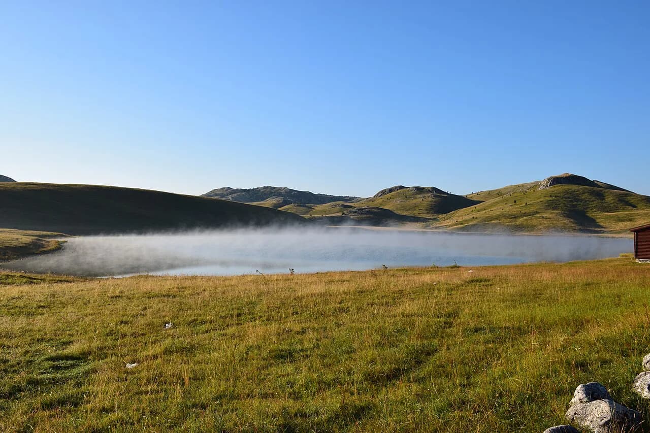
Riblje jezero is a small lake on the Jezerska visoravan, the open plateau south of Žabljak and east of the Tara canyon, and it is best planned as a half-day plateau drive rather than a mountain day. The lake sits at 1,409 m on a lake surface known as the Grčka Strana, with a greatest depth of 5.5 m that marks it out as a shallow plateau lake, not a swimming or boating destination. This guide fixes it on the map, sets out how the plateau road works from Žabljak, and adds the medieval stećci sites within walking reach.
Where Riblje jezero sits on the plateau
Riblje jezero belongs to the Jezerska visoravan, the meadow plateau lying south of Žabljak and the canyon of the Tara, between the Sinjajevina range and the massif of Durmitor. Its position explains the landscape: a gentle, grassy basin with pools and permanent lakes rather than the steep rock faces people picture when they think of Durmitor. The plateau holds several of these lakes, and Riblje jezero and Vražje jezero stand out among them for their size and setting, so treat the plateau as the unit of your outing rather than the lake alone.
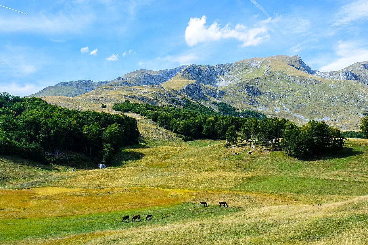
The geography pays off on a clear day. The plateau surface is a calm, low-lying expanse between the Sinjajevina range and the main Durmitor massif, and the skyline is closed by the wall of Šljeme and the other peaks around Savin kuk and Crvena greda. Bring a map or offline navigation, because tracks across the grassland fork and look alike.
Treat the altitude as real. At 1,409 m the air is noticeably cooler than in town, the grass is short and grazed, and cloud can drop over the plateau within an hour. If you have not driven on mountain roads before, plan to arrive earlier in the day when visibility is more reliable.

How to reach Riblje jezero from Žabljak
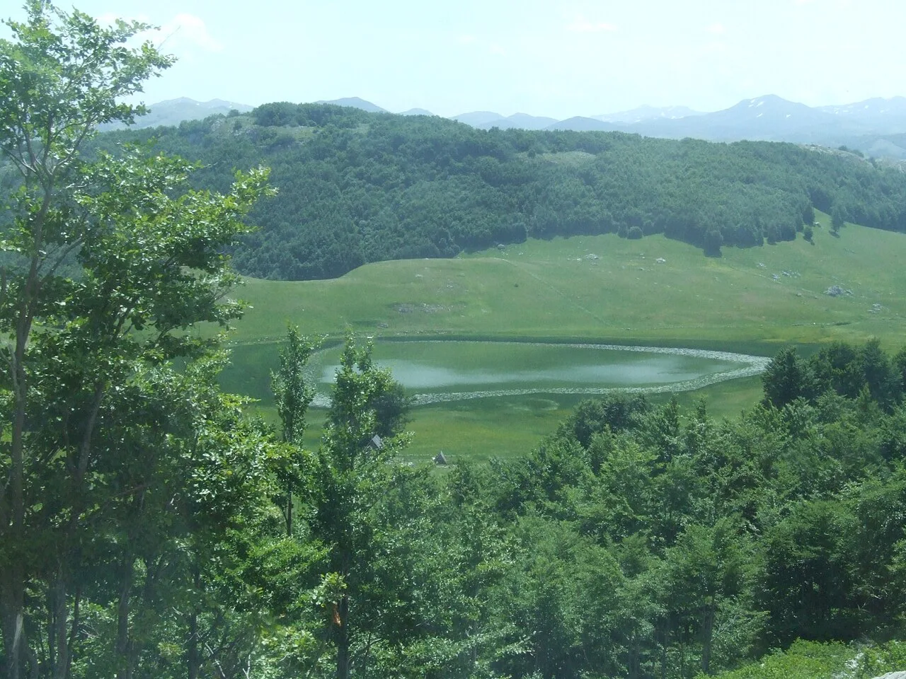
You reach Riblje jezero by road from Žabljak onto the Jezerska visoravan, which puts several plateau lakes within one short outing. Start from Žabljak, follow the signs for the plateau lakes, and use the neighbouring Vražje jezero as your marker on the drive. Driving rather than walking lets you stop at the stećci sites on the way, and the wider Žabljak attractions guide shows what else fits the same day.
The road onto the plateau is a rural mountain road, and surface conditions vary through the season. Confirm the current route and any road condition updates with the tourist organisation in Žabljak or at the national park information point in town before setting out, particularly after rain, and ask on the spot about access and parking rather than relying on an old map.
If you walk rather than drive, stay on the established tracks across the grassland; the plateau is grazing land and shortcuts cut through soft, uneven ground. Carry water and a windproof layer, since the plateau is exposed and the weather shifts quickly at this altitude.

The two lakes: Riblje jezero and Vražje jezero
Riblje jezero carries an unusual depth profile for a mountain lake: the greatest depth is about 5.5 m, and it sits on the flat plateau rather than in a carved valley. That makes it a place for looking and walking the shore rather than a swimming or boating stop.
Vražje jezero is the neighbouring lake on the same plateau and the natural pairing on a single drive. Visit both while you are there: Riblje jezero's shallowness and grassy surroundings give it a character of its own, so the outing is more interesting than one lake alone.
The lake's name comes from popular tradition rather than records. Local storytelling links Riblje jezero to an abundance of fish, including large specimens, and the shallowness and grassy surroundings fit the picture of a quiet fishing hollow rather than a resort. Treat the old tales as folklore, not fact.
The stećci at Grčko groblje and Žugića Bare
The plateau's second draw is medieval. Near Riblje jezero, at a site known as Grčko groblje, the stećci are carved medieval tombstones of the sort found across the Dinaric region, and the nearby Žugića Bare is the second necropolis on the plateau. Together they put a heritage stop on the same drive as the lakes, and both lie on the plateau within reach of the lake area without a long detour.
Twenty-odd selected stećci necropolises, including the Durmitor ones, are on the UNESCO World Heritage list, which is the reason for treating the stones carefully and not walking on them. Look at the carved surfaces rather than climbing: the site is a cemetery, not a viewpoint.
The plateau's steppe-like grassland reads as a clear contrast to the alpine scenery for which Durmitor is known, which is why the drive pairs the lakes and the tombs as one landscape. Keep the visits to the necropolises short and quiet, and take photographs from the path rather than from the stones.
How long to allow on the plateau
Give Riblje jezero a short stop of its own: walk the shore, take in the view towards Šljeme, and move on. If you add the two stećci sites on foot and the drive over to Vražje jezero, the plateau becomes a half-day rather than an hour. The trade-off is simple: the lake alone is quick, while walking between the necropolises and the neighbouring lake is what the plateau rewards.
Start early if you want to combine the plateau with anything else in the area, since the weather on the plateau changes fast and the light fades in the afternoon. Group the lake with Vražje jezero and the stećci in one drive rather than returning to Žabljak in between.
Nearby: other plateau lakes and Žabljak
The plateau lakes work as a group. Zminje jezero, a forested lake near the plateau edge, and Barno jezero are the other obvious stops within the same outing. Each adds only a short link to the drive, which is why they are worth planning together.
If you have a full day, extend the loop beyond the plateau rather than staying on the lakes alone. Sedlo Pass (Prevoj Sedlo) cuts through the main Durmitor massif and is a natural next leg after the plateau lakes, and the Sušica canyon lays out a different landscape again towards the north-east. Check the route and conditions before committing to either.
Žabljak is the practical base for the plateau: food, fuel and information are all in town, and the plateau road starts from there. Leave the lake as the first stop of the day before cloud builds.
Practical notes for the plateau
The plateau is grassland: the ground underfoot is uneven, the shores can be soft, and there are no facilities at Riblje jezero or the stećci sites. Wear walking shoes rather than sandals, carry water and a windproof shell, and check the forecast before you leave Žabljak, since conditions at 1,409 m are not the conditions in town.
Fishing rules, any permits, parking arrangements and vehicle access are not something to guess at, so ask at the national park information point in Žabljak or with the local tourist organisation before relying on any of them. The same applies to guided visits: if you want a guide, arrange it in town rather than assuming one on site.
Is Riblje jezero worth the plateau drive?
Yes, as part of a plateau outing rather than a destination on its own. Riblje jezero gives you a shallow, quiet lake at 1,409 m, with the neighbouring Vražje jezero and the medieval stećci at Grčko groblje and Žugića Bare on the same plateau, all on one drive from Žabljak.
The decision is mainly a question of time: the lake alone is a short stop, while the full loop between the lakes and the necropolises fills half a day. Check current road, weather and access conditions in Žabljak before you set out, and start early enough to leave the plateau before cloud builds.
Frequently Asked Questions
Can you swim in Riblje jezero?
No beach, lifeguard or swimming arrangement is published for it, and the lake is a shallow plateau basin in open grassland with no facilities. Treat it as a place to walk the shore and view the plateau rather than a swimming stop, and ask at the national park information point in Žabljak if you plan anything more.
Is Riblje jezero reachable by car?
Riblje jezero is reached by road from Žabljak onto the Jezerska visoravan plateau, with Vražje jezero as the neighbouring stop. The road is rural and mountain conditions vary, so confirm the current route and road condition in Žabljak before setting out.
How far is Riblje jezero from Žabljak?
The lake sits on the plateau south of town and east of the Tara canyon, on the same plateau as Vražje jezero. Exact distances depend on your route, so ask in Žabljak when you arrive rather than guessing from a map.
What are the stećci near Riblje jezero?
They are medieval carved tombstones, found at Grčko groblje by Riblje jezero and at the nearby Žugića Bare necropolis. Selected stećci sites, including the Durmitor ones, are on the UNESCO World Heritage list, so look at the carvings from the path and keep off the stones.