Biogradsko Lake: Visiting the Lake in Biogradska Gora
Biogradsko Lake sits at about 1,094 m on Mount Bjelasica inside Biogradska Gora National Park. Here is how to walk the lakeside path and what to expect.
On this page
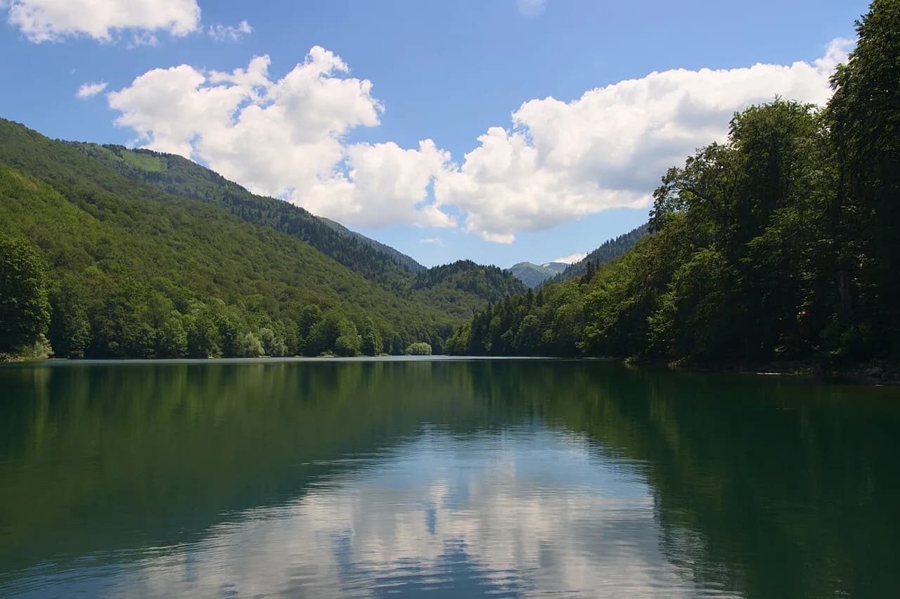
Biogradsko Lake is a glacial lake at about 1,094 m on Mount Bjelasica and the largest lake on that mountain, sitting inside Biogradska Gora National Park between Kolašin and Mojkovac. A visit is mostly a gentle lakeside walk on paths and wooden walkways rather than a long expedition, which makes it an easy half-day from Kolašin. This guide covers the lake's scale, the circuit around it, the protected forest, and the practical details of getting there.
Expect cool mountain air, forest reflections on calm water and a short list of things to do: walk the shore, look into the old-growth woodland on marked routes, and take photographs. Treat the boat question and any facilities as things to check at the entrance or in Kolašin rather than assuming they are there.
What and where Biogradsko Lake is
The lake lies at approximately 1,094 m above sea level and covers around 0.22 sq km, with a maximum depth of about 12.1 m, according to the UNESCO tentative-list entry for the park. Those figures give a sense of scale: this is a compact mountain lake you can see across, not a vast expanse of water.
It sits in the mountains between Kolašin and Mojkovac, and Kolašin is the usual base for a day trip. The lake is the best-known natural attraction in Biogradska Gora National Park, and most visits revolve around it rather than around the wider park.
The park itself was established in 1952. Protection of the area around the lake goes back further: in 1878 Prince Nikola Petrović-Njegoš set the land aside as a reserve known as Branik, or the Prince's Reserve. If you continue north-east towards Mojkovac, the town makes a natural second stop on the same day.
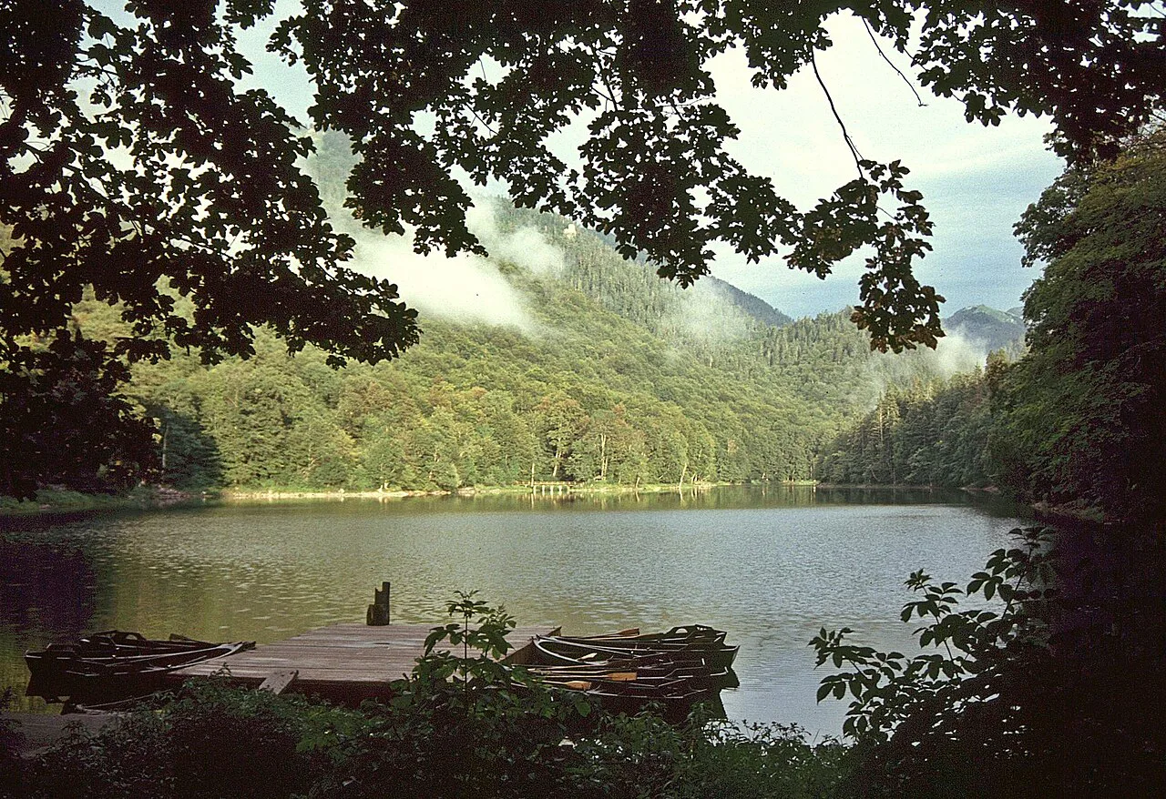
Walking the lakeside path
A path runs around the lake through the forest, with wooden walkways and viewing spots set up for looking out over the water and taking photographs. The circuit is a relaxed walk rather than a demanding route, so allow time to stop rather than treating it as a box to tick.
The lake changes character through the year, from fresh spring greenery to summer foliage and autumn colour, and the reflections of the surrounding slopes are the main draw for photographers. Go early in the day if you want still water and fewer people on the walkways.
Stay on the designated paths and follow park guidance. The ground beside the trail is sensitive, and stepping off the walkways to reach the water damages what you came to see.
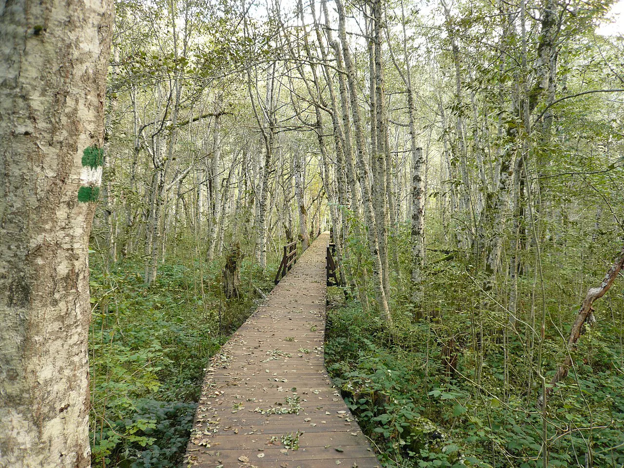
The primeval forest around the lake
The old-growth forest is the other reason to come. Old trees, moss-covered ground and a dense understory have developed here over centuries, and the woodland is the park's defining feature for anyone interested in natural landscapes.
Beyond the lake, marked routes lead further into the forest and up into the surrounding mountains. Choose a route that matches your fitness and experience, and allow extra time for mountain weather that can change quickly.
The wider massif has other walking country if you want more than a lakeside stroll, and the park sits at the foot of it. Treat the forest as a protected area with designated routes rather than open ground to wander.
Photography and wildlife
Forest, mountain scenery and the shifting colours of the seasons are the reliable subjects. Birds and other animals live in the park, but sightings depend on luck and quiet, and no one can promise them.
Keep a respectful distance from any animal you do see, and never feed or disturb it. Photograph from the path rather than moving into the trees for a closer shot.
Boats on the lake
The lakeside path, the forest and the viewpoints are the established draws. If rowing or a boat trip is part of your plan, ask at the park entrance or in Kolašin before you set out rather than assuming a service runs.
Getting there from Kolašin
The lake is a day trip from Kolašin, and staying in the town makes it straightforward to combine the park with other sights in the area. The drive heads towards Mojkovac before turning off for the park entrance.
From the entrance, the lake is reached on foot, and the paths and walkways begin from the visitor area. The park is described as a destination for all seasons, so the walk is not limited to high summer, though mountain weather and trail conditions should be checked before you go.
Allow more time than the walk alone suggests if you want to see the forest as well as the shore. A relaxed circuit plus a stretch of woodland path fills a morning comfortably.
Practical notes for the visit
Wear suitable footwear for forest paths and carry water. The lake sits at about 1,094 m, so conditions are cooler and changeable compared with the coast, and the weather can shift during a walk.
Park guidance asks visitors to keep to marked routes, avoid disturbing wildlife and respect the protected area. Check current trail and access information before setting out, particularly outside the warmer months.
Confirm any admission arrangements, opening times and facilities at the park entrance on arrival, as these are not fixed in advance in the published visitor information.
How much time does the lake need?
A relaxed circuit of Biogradsko Lake plus a section of forest path is a comfortable half-day from Kolašin. Build in extra time for photographs, for the walkways, and for weather that may slow you down.
Go with suitable footwear, water and a willingness to stay on the marked routes, and treat the boat question and any facilities as things to confirm on the ground. The lake rewards a slow visit rather than a quick stop.
Explore more Kolašin guides
Frequently Asked Questions
Is Biogradsko Lake the largest lake in Montenegro?
No. It is the largest lake on Mount Bjelasica, with a surface area of around 0.22 sq km and a maximum depth of about 12.1 m, according to the UNESCO tentative-list entry for the park. Lake Skadar is the country's major lake on a different scale, and the two are not comparable as visits.
Can you swim in Biogradsko Lake?
The park's visitor information covers the lakeside path, the viewpoints and the forest, and does not describe swimming. Ask at the park entrance whether swimming is permitted before you plan on it.
How do you reach Biogradsko Lake without a car?
The lake is reached from the park entrance on foot, and the entrance sits between Kolašin and Mojkovac. Local transfer options and any seasonal services are not set out in the park's published information, so arrange transport from Kolašin directly.
Sources
Notes for your Montenegro trip
Optional updates to our Montenegro town guides.
You might also like
Continue reading
More guides you'll find useful