Cetinje Map: Landmarks, Walking Distances and Where to Park
A practical Cetinje map guide: where the monastery, museums and palaces sit, how the centre fits together on foot and where a car is actually useful.
On this page
Cetinje fits on a single page: the old royal capital is compact, walkable and best navigated with the Cetinje Monastery as your fixed reference point. Almost everything else you will want to see sits within a short stroll of it, so you rarely need a car until you head up to Lovćen. This guide sets out how the centre is laid out, which buildings belong to which museum, and how to arrive without wasting the morning on orientation.
Treat the map as a walking plan rather than a driving one. A car earns its place mainly for the climb to the Njegoš Mausoleum, 13 km from Cetinje, where a plateau with a restaurant, ticket shop and souvenir store sits at the foot of the steps. Read on for the landmarks in the order you will meet them, the monastery hours, and how to tell the National Museum's separate buildings apart.
What the Cetinje map looks like: a compact royal capital you can cross on foot
Cetinje was founded in the 15th century and grew into the centre of Montenegrin culture, with much of its architecture and grandeur laid out from the 1800s onwards. It became the capital of an independent Montenegro in 1878, and the capital moved to Podgorica in 1946. That is why the centre reads as a set of grand set pieces — palaces, embassy buildings, churches and shaded parks — packed into a few wide streets.
For map purposes, the town has one core. The streets are broad and largely pedestrian, the parks give you places to pause, and every block turns up something worth a look. You can walk the streets yourself rather than following a fixed circuit, which is the quickest way to understand the layout.
The practical trade-off is that a paper or offline map of Cetinje needs very few pins on it. Plot the monastery, the National Museum buildings, the Biljarda and the Museum of King Nikola, and the rest is wandering. Save the detailed navigation for the mountain road out of town.
Orienting yourself: the monastery as the reference point
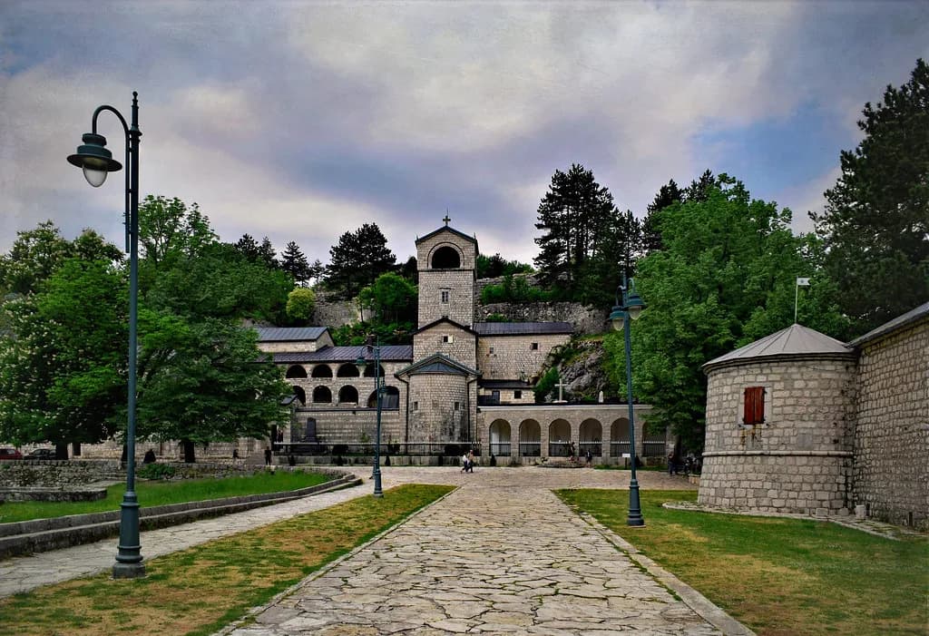
Start every route at the Cetinje Monastery, also known as the Monastery of Saint Peter, which is the most important sight in town and the easiest anchor for directions. Built in 1484 by Ivan Crnojević, it has been destroyed and rebuilt over the centuries and holds the relics of St Peter of Cetinje and tombs of Montenegrin leaders.
The monastery is open daily from 08:00 to 20:00 and there is no entrance fee, so it works as a first stop whatever time you arrive. Photography is forbidden inside the monastery complex, which is worth knowing before you plan a photo circuit around it. The main National Museum building sits across from the monastery, so you can step from one to the other without consulting a map at all.
The Metropolitanate of Montenegro is bound up with this site, so read up on the context before you arrive rather than trying to absorb it on the pavement. Then use the monastery door as your compass: everything else in the centre is described in relation to it.
The National Museum of Montenegro and its separate buildings
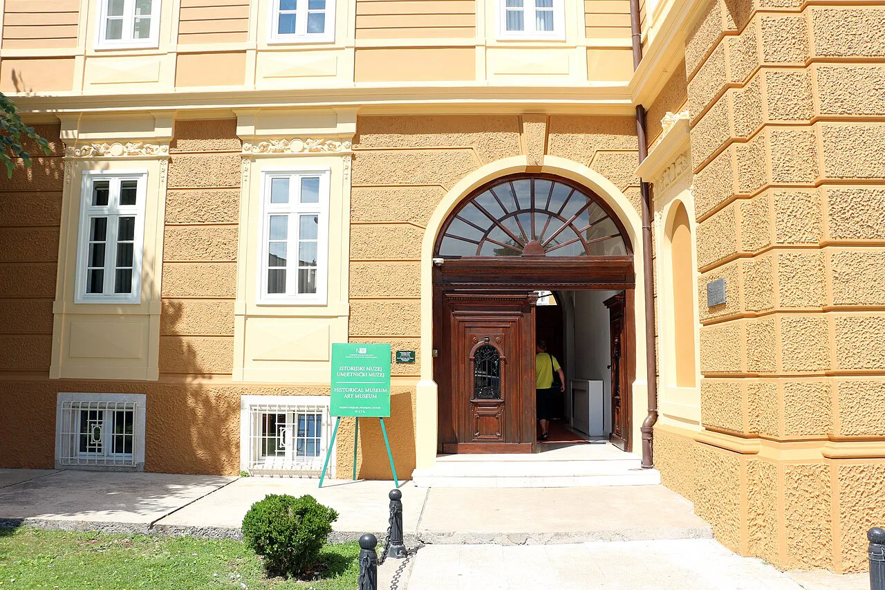
The building usually called the National Museum of Montenegro is not one museum but part of a wider museum group spread across several buildings, some of which contain more than one institution, so it pays to know which door you want before setting out. You can pay at each separately or buy a combined ticket for 12 euros to see them all, the price given by Time Travel Turtle.
On the map, mark the main building opposite the monastery first, then add the others as separate pins rather than expecting one address. That is the most common mapping mistake in Cetinje: people arrive at the museum building by the monastery and assume everything is inside.
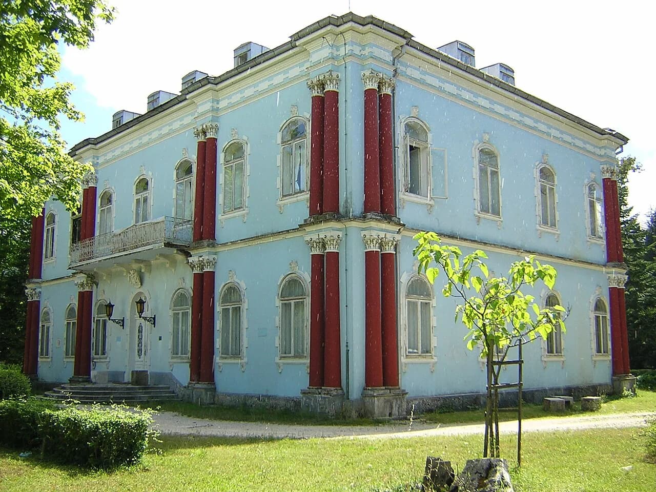
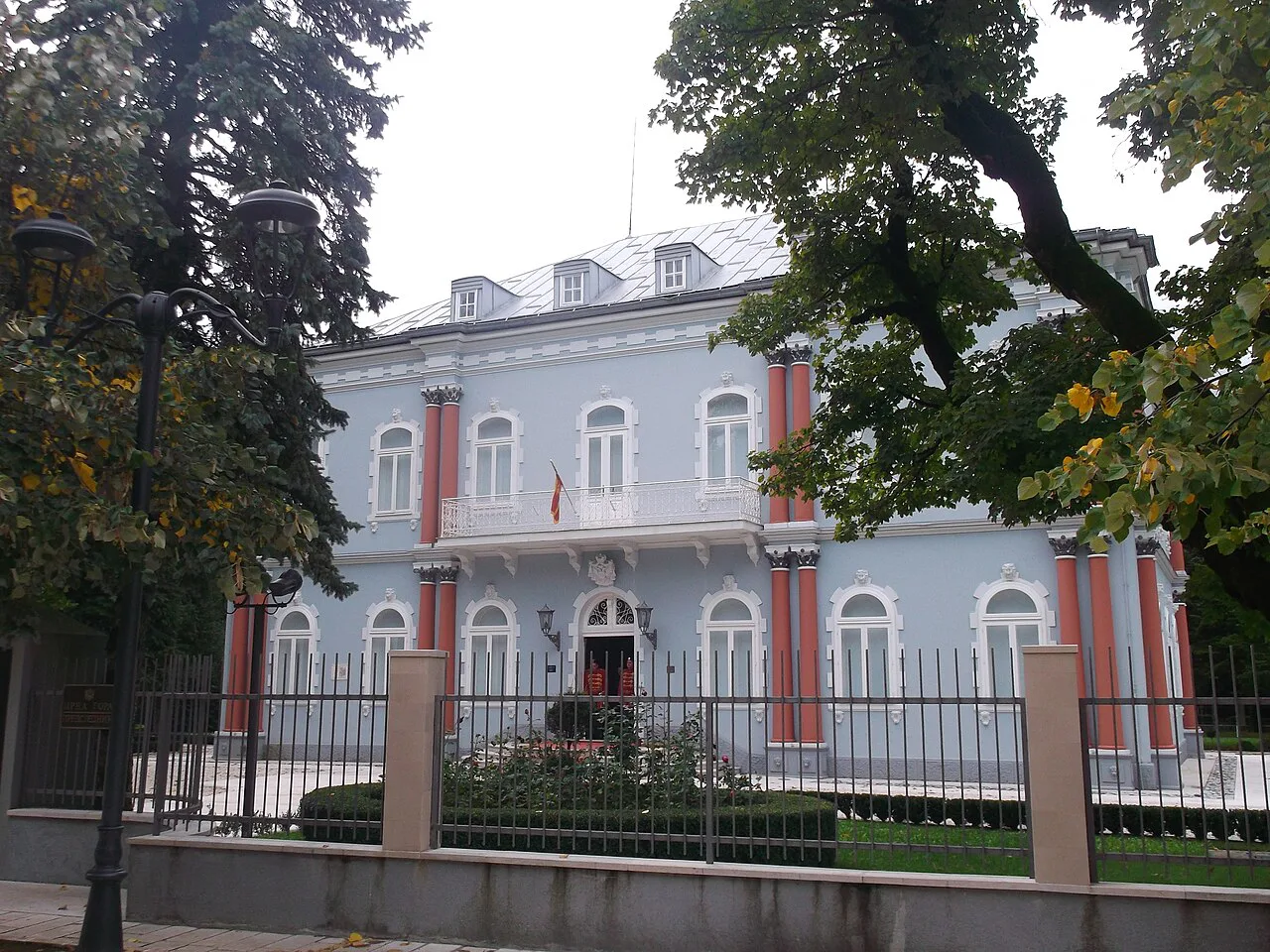
Also worth a pin is the Blue Palace in Cetinje, one of the former royal residences that gives the town its ceremonial character. It sits among the palaces and embassy buildings of the centre, so it slots naturally into a walking loop rather than a separate trip.
Biljarda and the Museum of King Nikola
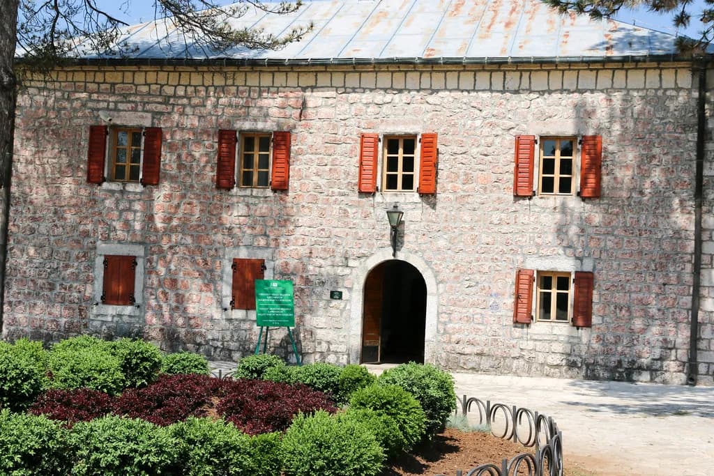
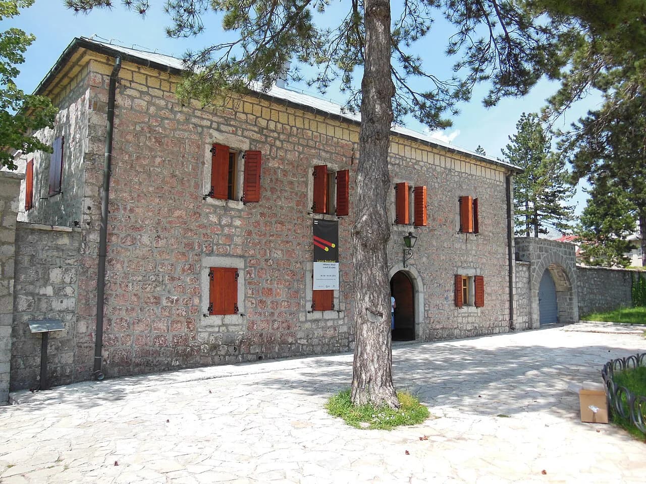
Two more pins complete the museum map. The Njegoš Museum Biljarda, known in English as the Billiard Palace, is a stone building from 1838 built with Russian aid, once a residence and state institution, and now houses Njegoš's museum, including a vintage pool table among its exhibits.
The Museum of King Nikola covers the royal side of the story and is listed among the museums of Cetinje in the same national collection, so check which ticket covers which building when you arrive rather than buying twice. Both sit in the compact centre, so you can visit one, walk a few minutes and visit the other.
If you want the Biljarda in detail — its architecture, its collections and how it fits Njegoš's story — give it its own slot rather than treating it as a quick look between the monastery and the museum.
Walking the centre: wide streets, parks and embassy buildings
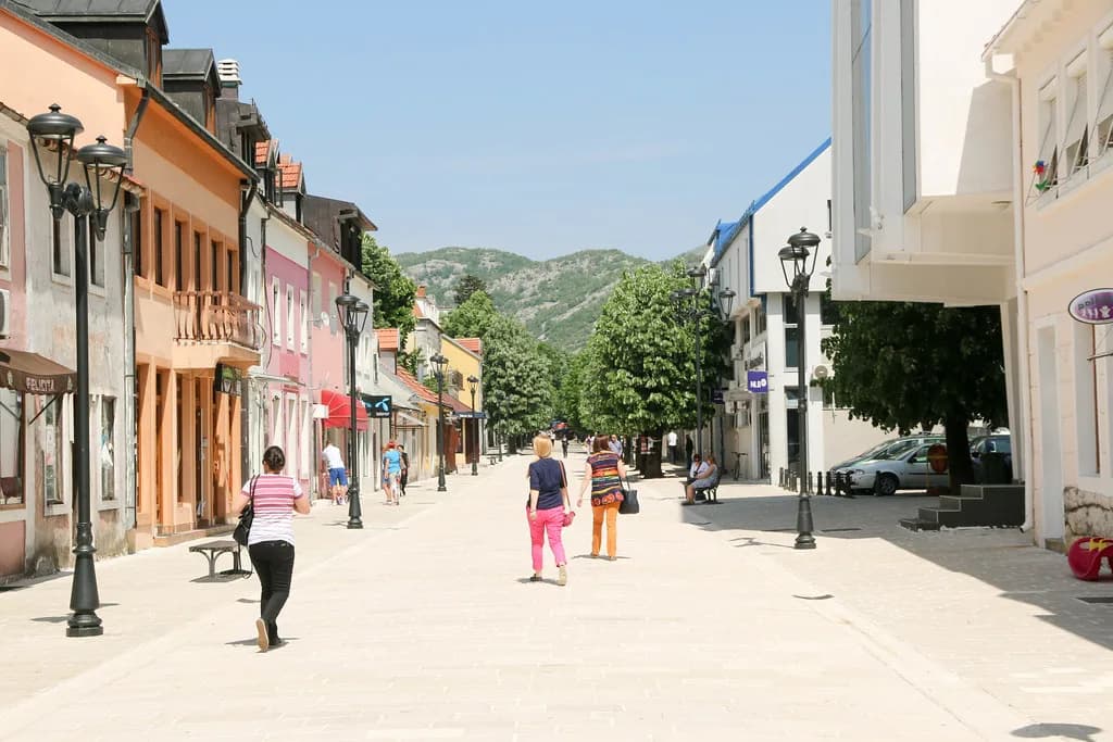
Cetinje's centre is generous with space: wide pedestrian areas, shaded parks and a steady supply of old royal palaces, grand embassy buildings and intricately designed churches on every block. In the heat of the day the locals retreat and the streets go quiet, which makes the walking more pleasant rather than less interesting.
Plan your walk in a figure of eight rather than a line. The monastery and main museum building form one loop, the Biljarda and King Nikola museum another, and the parks between them give you shade and a place to sit. Because the distances are short, errands back and forth cost minutes rather than journeys.
One honest caution: the centre is small enough that you may finish the core sights sooner than you expect. Build in either a museum you actually want to linger in, or the Lovćen extension described below.
Arriving by car: parking and using the centre as your base
For a visit to Lovćen National Park, most guests use their own or a rented car, and the same vehicle takes you into Cetinje. The park's slopes rise steeply from the Budva coast and the west side of Cetinje, bordered on the south by the Budva–Cetinje highway and on the north by the old Kotor road, so your approach direction shapes your first view of the town.
Use the centre as your base rather than parking at the first sight. Leave the car once, walk the compact core, and move it only when you leave for the mountain. Parking arrangements and charges in the centre are not listed in the sources consulted here, so check locally on arrival instead of budgeting on guesswork.
Driving within Cetinje is largely pointless given how short the walking distances are. Keep the car for the road up to Ivanova Korita and the mausoleum, and treat the town itself as a pedestrian zone with a few streets attached.
Arriving by bus: connections to Bar, Budva and Podgorica
Cetinje sits on busy bus corridors: much of the traffic runs between Cetinje, Bar, Budva and Podgorica, which makes a car-free visit feasible.
Once off the bus, the centre is walkable, and a taxi is the fallback for reaching the park if you are not driving. Timetables and fares are not listed in the sources used here, so confirm the return service before you set off rather than assuming an evening bus.
For a full picture of what the town holds beyond the museum circuit, see Cetinje: the Old Royal Capital, Its Museums and Monastery, which sets out the sights and how they fit together. It is the better read before you go; this page is for placing those sights on the ground.
Extending the map: Lovćen and the Njegoš Mausoleum
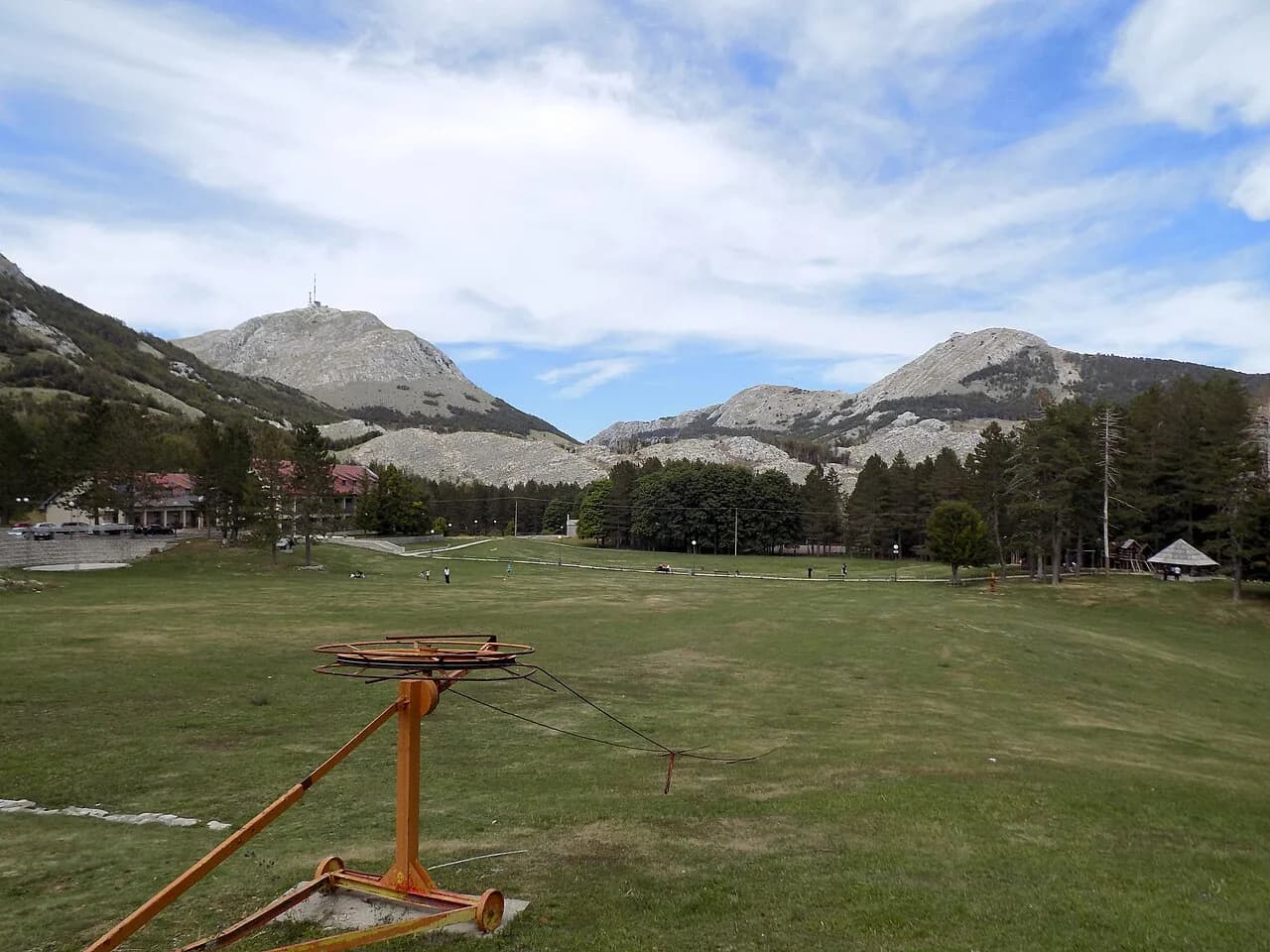
The one extension that justifies a wider map is Lovćen. The national park rises to 1,749 metres, covers 6,220 acres and combines Mediterranean and continental climate zones across nine habitats, with around 2,000 plant species recorded.
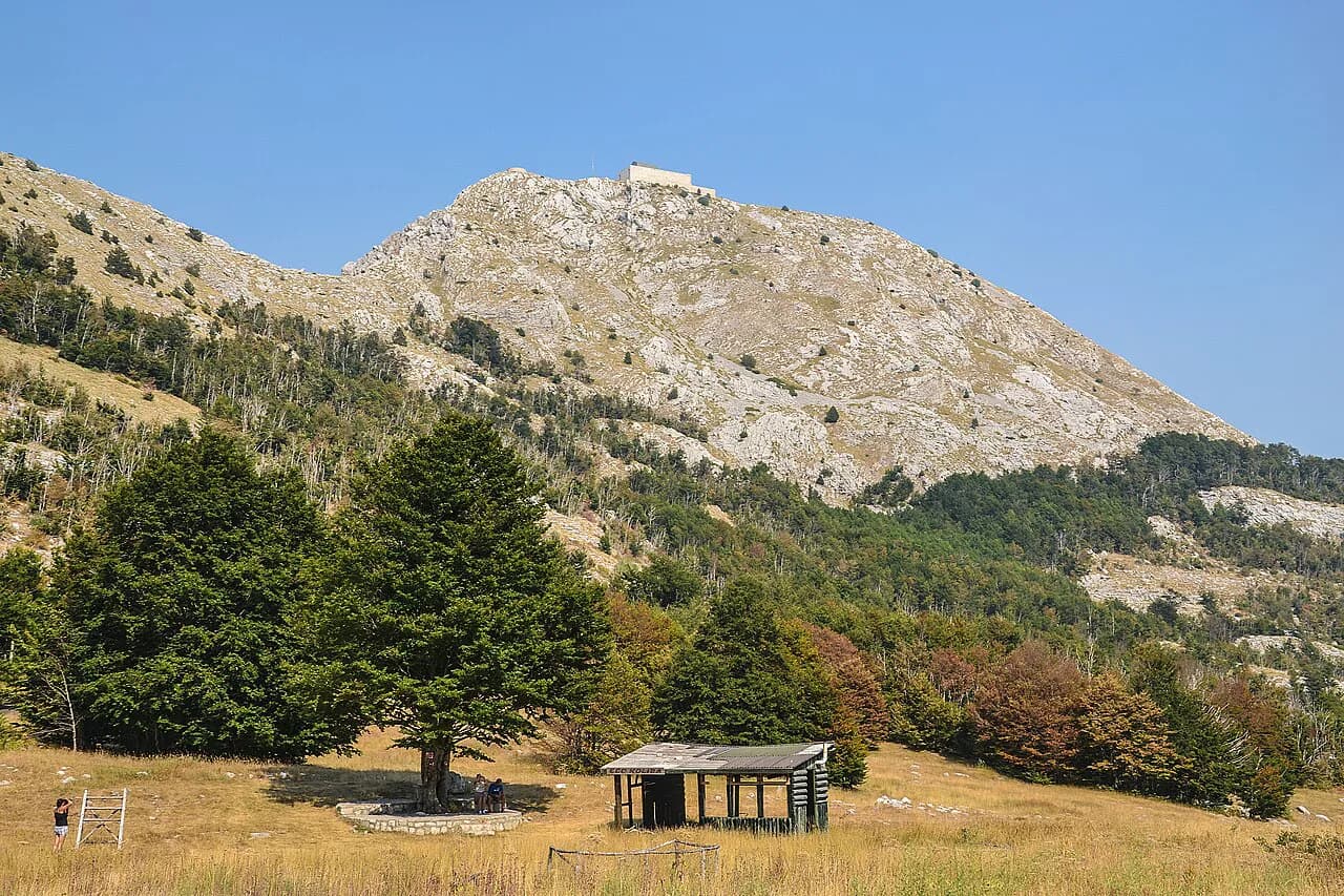
At Jezerski vrh on the mountain stands the Njegoš Mausoleum, reached from Cetinje by a 13 km drive up through Ivana Korita. The approach runs through beech, oak and linden forest, and an asphalt road brings you to a plateau with a restaurant, ticket shop and souvenir store; from there 461 stone steps and a marble tunnel lead to the entrance.
The mausoleum itself was conceived by sculptor Ivan Meštrović, replacing Njegoš's original chapel burial site, and construction began in 1951 and opened to the public in 1974. Inside, a crypt holds a white marble sarcophagus, and the facade carries a figure of Njegoš with a grey eagle above it.
The climb is a real climb: the steps demand effort, and the advice to take short pauses is sound rather than polite. From the top, the view takes in Kotor Bay, the open sea, Skadar Lake, Prokletije and Cetinje, which is why visits peak between May and October. For those on foot, marked mountain tracks reach the mountain from Budva, Tivat, Cetinje and Njeguši.
Which map to carry: offline app versus printed plan
Carry an offline map on your phone for the mountain road, where signal and signage matter more than street detail, and rely on memory and a single printed plan for the town centre. The centre's pins are few enough to hold in your head once you have walked the monastery loop.
Before you leave the coast, save the route over the Krstac saddle on the Kotor–Njeguši–Cetinje road, which the mausoleum source gives as the driving line from Ivana Korita. Note the two bounding roads of the park — the Budva–Cetinje highway and the old Kotor road — so you know which side you are approaching from.
If you prefer to have the town's sights written out rather than pinned, see Cetinje: the Old Royal Capital, Its Museums and Monastery for the monasteries, museums and surrounding villages including Njeguši and Rijeka Crnojevića. Use it alongside the map rather than instead of it.
Where to start when you arrive
Arrive, leave the car, and walk to the monastery first. From there the main museum building is opposite, the Biljarda and the Museum of King Nikola are a short stroll away, and the parks fill the gaps between them. That is the whole map of central Cetinje, and it will take less time than you have allowed.
Spend the time you save on the drive up to Jezerski vrh. Check the monastery hours and the mausoleum's current arrangements before you set out, since the figures above are the ones the sources give rather than guaranteed tariffs, and confirm bus times for your return leg.
Explore more Cetinje guides
Sources
Notes for your Montenegro trip
Optional updates to our Montenegro town guides.
You might also like
Continue reading
More guides you'll find useful