Prokletije National Park: A Guide to Montenegro's Accursed Mountains
Prokletije National Park spans Plav and Gusinje, with Hrid lake, the Grlja gorge and the Zla Kolata summit. Here is what to see and how to plan a visit.
On this page
Prokletije National Park is Montenegro's youngest national park, established in 2009, and it spreads across the municipalities of Plav and Gusinje in the far south of the country. The park covers 1,660 hectares and includes Zla Kolata, at 2,534 metres the highest peak in Montenegro. Visitors come for the Hrid lake, the Grlja gorge and the two nature reserves, not for a single set-piece sight. This guide covers the two gateway towns, the heritage stops around the park and how to reach the main valleys.
The park sits at the southern end of the Dinaric Alps and forms Montenegro's natural border with Albania and Kosovo. The name Prokletije means 'cursed', a reference to the inaccessible and difficult peaks, secret lakes and steep cliffs that define the massif. Do not expect a single hub to organise everything: the Plav and Gusinje sides are reached from different villages, so plan your base by which reserve or valley you want to see first. For the two gateway towns, see Plav, Montenegro and Gusinje: What to See in the Town Below Prokletije.
What Prokletije National Park is and where it sits
Prokletije is the newest national park in Montenegro and in the wider Dinaric region. It was designated in 2009 mainly because of its flora and fauna, which make the area a centre of high-mountain diversity, together with its distinctive relief and rich waters. The park extends over the territory of Plav and Gusinje. It has two nature reserves, Hridsko jezero on the Plav side and Volušnica on the Gusinje side, each chosen for exceptional natural values and floristic and landscape quality.
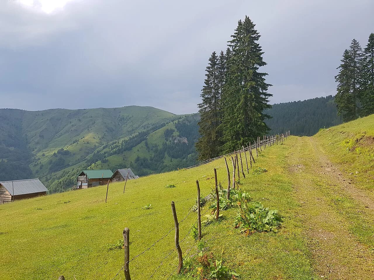
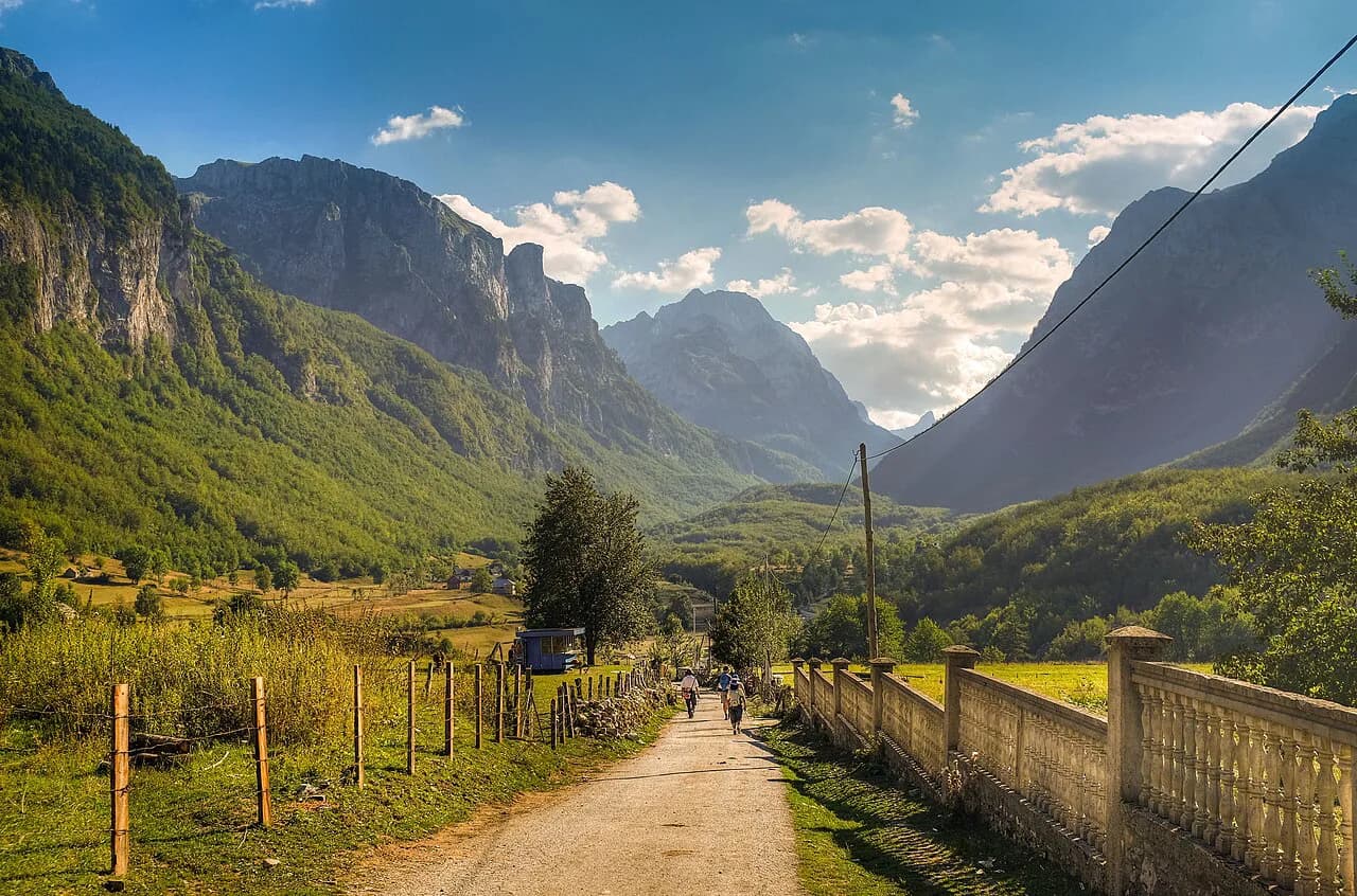
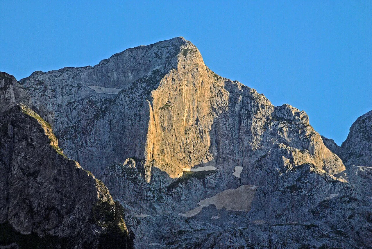
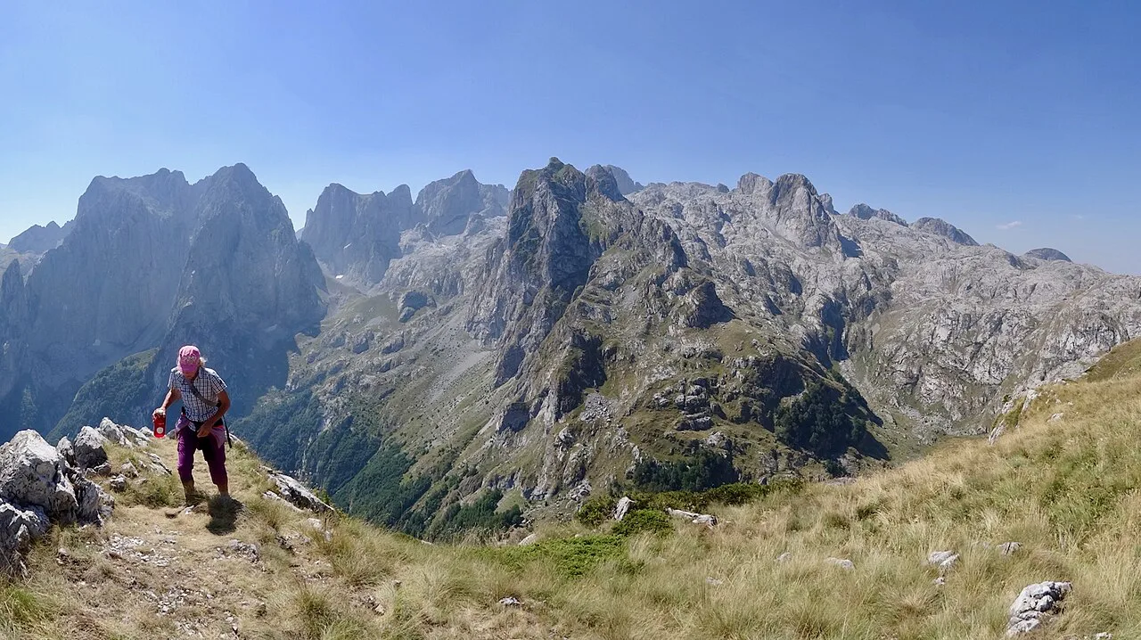
The terrain is rugged, with numerous heights, gorges, steep slopes and alpine-type river valleys. That variety is why the massif draws mountaineers and alpinists as well as general visitors. Twenty peaks rise above 2,500 metres, so the park is a mountain destination first. The park's edges run along international boundaries, so take your passport if you plan to venture near them.
Plav and Gusinje: the two gateways to the park
Plav and Gusinje are the two municipalities that share the park, and they function as the practical gateways. Plav sits by Lake Plav and gives access to the Plav-side reserve at Hridsko jezero. Gusinje is the closer base for Volušnica and the Grlja gorge, and it has the visitor centre that arranges local guides. The two towns are close enough to use one as a base for both, but the road and walking distances differ, so pick your base by the day you have planned.
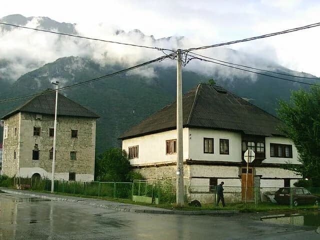
Gusinje has the larger concentration of heritage sites in and around the town, including the Vizier Mosque from the 17th century and the Redžepagić tower. The town also has a visitor centre where you can get information on walking and climbing routes and make contact with local guides. If you plan to walk without a car, Gusinje is the more useful base because you can arrange transport and guides in one place. For more on the town itself, see Gusinje: What to See in the Town Below Prokletije.
The Zla Kolata summit and what the terrain asks of you
Zla Kolata is the highest point in Montenegro at 2,534 metres, and it lies within Prokletije National Park. The park's official tourism listing notes that 20 peaks rise above 2,500 metres, so Zla Kolata is one of a group of serious summits rather than an isolated objective. The terrain is rugged, with gorges, steep slopes and alpine-type river valleys. That combination makes a summit attempt a full mountain day, not a stroll from the car park.
The park page says the massif is a favourite with mountaineers and alpinists because of its beauty and inaccessibility. It also describes twenty peaks above 2,500 metres as a challenge even for experienced mountaineers. That is your warning to match your route to your experience and to go with a local guide if you are unsure. The visitor centre is the place to ask about routes and local guides rather than relying on an app alone.
Weather in the massif changes quickly, and the altitude range means you can start in warm valley conditions and finish in cold wind and rain. Carry warm and waterproof layers even on a clear morning, and do not treat a summer forecast for Plav as a forecast for the summit. No source here publishes summit conditions, so check locally before you set out.
Hridsko jezero (Lake of Happiness) in the Plav reserve
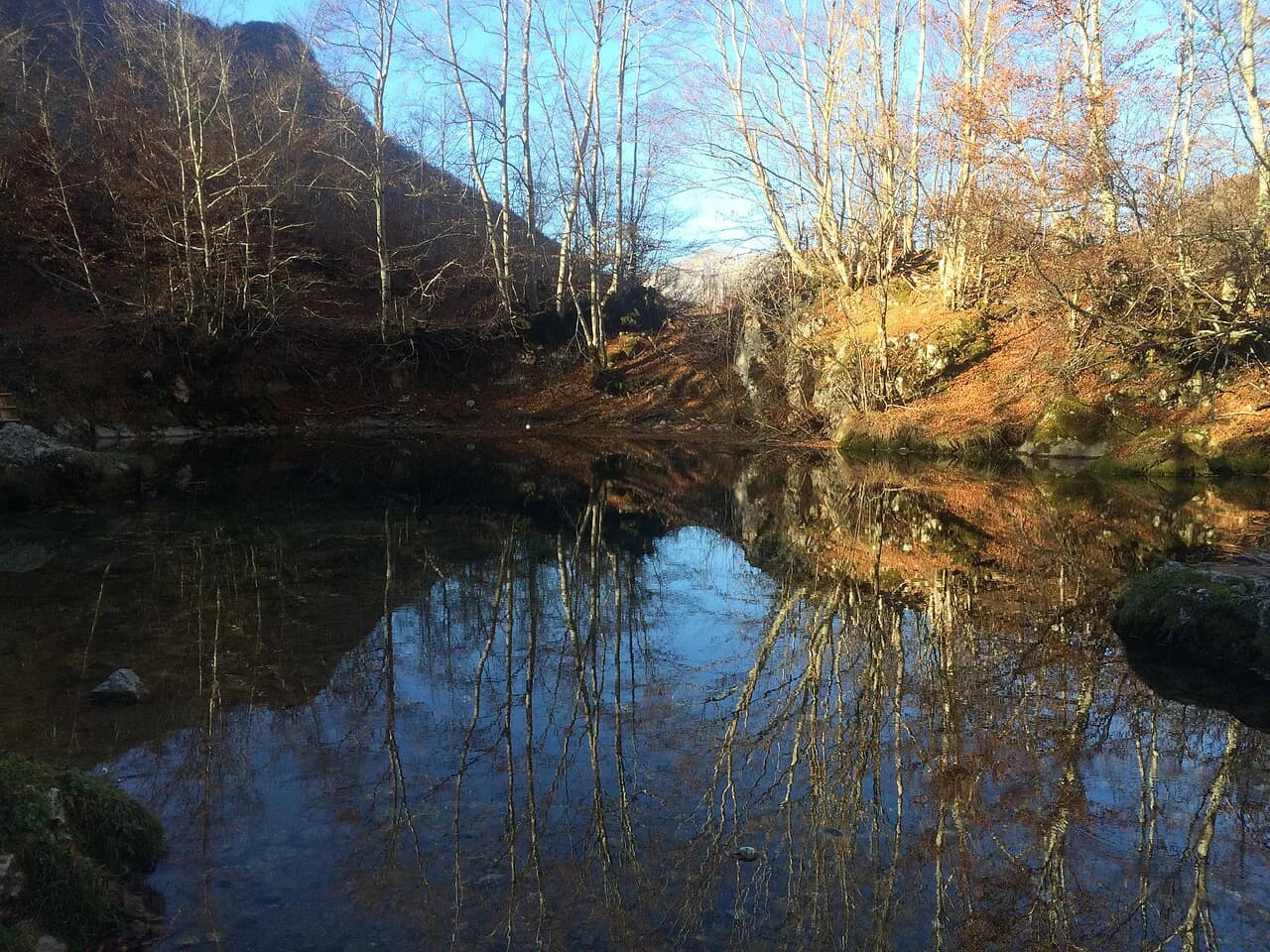
Hridsko jezero, also called the Lake of Happiness, is one of the park's two nature reserves and sits on the Plav side. The reserve has been singled out for its floristic and aesthetic character. Local tradition says the lake grants a wish, and visitors have thrown jewellery into the water as a sign of their wishes. That story makes the lake the park's gentlest outing: a short visit rather than a summit push.
The official Montenegro tourism page recommends the lake for visitors who do not want their park visit to become a 'mission impossible'. It describes the lake as the park's softer side and suggests making a wish before you visit. That framing is useful if you are travelling with family or have limited time. You do not need climbing equipment to see one of the park's reserves.
Access to the lake is from the Plav side, so base yourself in or near the town if this is your main objective. No source here publishes a fixed trailhead or a formal car park at the lake. Ask at the visitor centre in Gusinje or at your accommodation in Plav for the current route and any local guiding arrangements. Do not assume a marked path leads all the way from the road.
Volušnica reserve near Gusinje
Volušnica is the second of the park's two nature reserves and sits on the Gusinje side. Like Hridsko jezero, it was designated for exceptional natural values and for its floristic and landscape qualities. The reserve is visited from Gusinje, which makes it the natural counterpart to the Lake of Happiness for anyone staying on that side. If you have only one day and are based in Gusinje, Volušnica is the reserve to prioritise.
The park describes its valleys, including Grbaja and Ropojana, as habitats for high-mountain wildlife such as rabbit, wolf, brown bear, wild boar, chamois and roe deer. That means you are walking in active wildlife country, so keep food stored and do not approach animals. Ask at the visitor centre for current advice on walking safely in bear country.
Gusinje is the practical base for Volušnica, and the town has the visitor centre that covers walking and climbing routes. Use the centre to confirm the current state of paths and whether a local guide is recommended. The reserve is one of the park's protected areas, and access can change with conditions, so do not rely on a map alone.
The Grlja gorge and canyon country
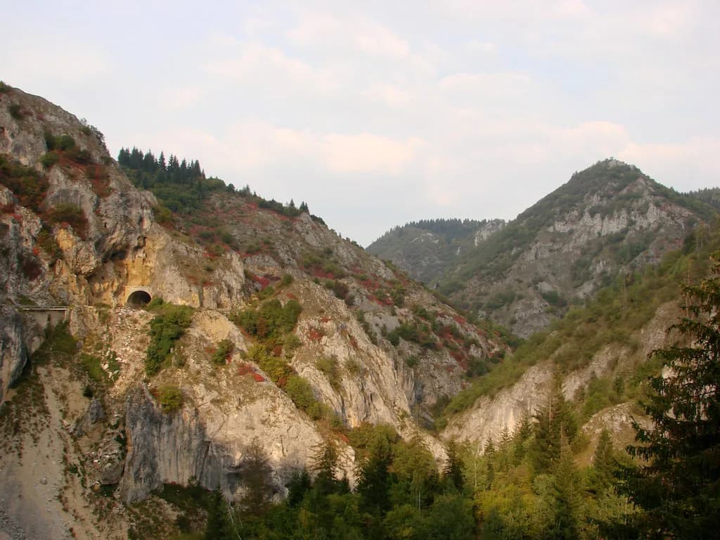
The Grlja gorge is one of the park's named features, listed alongside the peaks and lakes as a place to see. The official tourism page names it as an alternative to the better-known Nevidio canyon for visitors who want canyon scenery without the 'kamikaze gate'. That is a useful trade-off: Grlja gives you gorge scenery in Prokletije rather than a detour to the Tara or Nevidio areas. It suits walkers who want a dramatic valley day rather than a summit.
The gorge sits on the Gusinje side of the park. It is a canyon landscape, so expect rough ground, water and rock rather than a paved path. No source here publishes a route description or difficulty grade for Grlja. Ask at the visitor centre in Gusinje about the current approach and whether a guide is needed.
Flora, forests and wildlife you may notice
Prokletije is known for its biodiversity, and the park page describes it as home to almost 2,000 different plant species, which it says is half of Montenegro's total flora and almost a fifth of the Balkan flora. It also says the park is home to over 180 bird species and is the most important centre of herpetofauna diversity in the country. The same page notes a large number of endemics and almost half of the forests having a rainforest character, so treat these figures as the park's own count rather than a general survey. What matters for a visit is the variety: forests, alpine meadows and wetland around the lakes, with the most visible flowering in spring and early summer.
The official Montenegro tourism page gives a lower plant figure of 1,700 species and highlights wild garlic as a local speciality. If you need a number, use the park's own page and do not mix the two. Wildlife sightings are not guaranteed and most animals avoid people. Carry binoculars, keep your distance and store food properly if you are staying in the valleys.
Heritage stops around the park: Brezojevica monastery, Redžepagić tower and Gusinje mosques
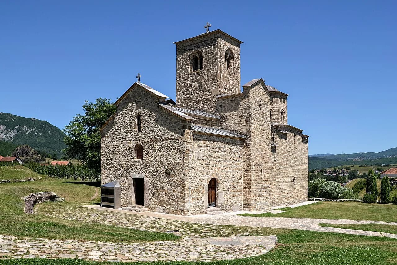
The park's official tourism page lists several heritage stops around the protected area: the historic Holy Trinity monastery in Brezojevica, the Redžepagić tower, the Old Imperial Mosque and the 17th-century Vizier Mosque in Gusinje. These are cultural stops rather than park facilities, so they work well as half-day add-ons when weather rules out a mountain day. Brezojevica is a separate village from Gusinje, so plan the drive between them rather than assuming they are walkable. Dress modestly at a working mosque or monastery and check at the door rather than assuming access outside prayer times.
These sites sit in and around Gusinje, which makes the town a sensible base if you want to combine heritage with the Volušnica reserve. The Redžepagić tower is a fortified residence, the kind of small stone tower found across the Balkan highlands, and the Old Imperial Mosque and Vizier Mosque are the town's main Islamic monuments. No source here publishes opening hours or entry charges for them. Ask at the visitor centre or at your accommodation for current access.
Ali Pasha's springs, 1.5 km from Gusinje
Ali Pasha's springs lie about 1.5 kilometres from Gusinje, according to the official Montenegro tourism page. The same page notes that locals living near the springs say the magic 'yes' is said here especially often, with 30 marriages held in a single day. That makes the springs an easy short excursion from the town rather than a mountain day. They pair well with the Vizier Mosque and the Redžepagić tower if you are spending a day in Gusinje.
A 1.5-kilometre distance from town means the springs can be reached on foot for most visitors, though the route may not follow a formal footpath, so ask locally which way is currently used. The springs are a picnic spot rather than a ticketed attraction. Take water and sun protection in summer.
The visitor centre and local guides
The visitor centre in Gusinje is where you get information about walking and climbing routes and make contact with local guides. That makes it the first stop on arrival rather than an optional extra, and it is also the place to check the current state of paths and any seasonal access issues. No source here publishes the centre's opening hours or charges, so confirm before you rely on it.
Local guides are arranged through the visitor centre, which means you do not need to find an operator online. That is a practical advantage if you are travelling without a car and need transport to a trailhead. Ask about group sizes and what is included before you commit, and let the centre match a route to your experience level.
When to go: seasons and what each one offers
The park's official tourism listing names spring, summer and winter as its seasons, with sport climbing, skiing, winter sport and canyoning among its top activities. That tells you the park runs year-round rather than closing after autumn. Spring and summer suit walkers and climbers, while winter brings snow sports. Neither season is recommended for all visitors, so match your trip to your experience.
Summer is the main walking season, but mountain weather can still turn cold and wet at altitude. Spring brings flowering and higher water in the gorges. Winter opens ski touring and snowboarding but demands avalanche awareness and equipment. No source here publishes a season-by-season safety brief, so ask locally before booking a winter trip.
Getting there and getting around Plav and Gusinje
Plav and Gusinje are the two municipalities that surround the park, so your transport planning starts from them. The tourist office in Gusinje is the contact point: Čaršijska b.b, 84326 Gusinje, phone +382 68 837 999, email turizam@opstinagusinje.me. Use the office to confirm current access and local transport options. No source here publishes bus timetables or road conditions for the park.
The park's valleys are reached by road from the two towns, and a car gives the most flexibility for combining Plav-side and Gusinje-side visits. Without a car, the visitor centre can put you in touch with local guides who can arrange transport. Plan your days around one side of the park to avoid unnecessary driving.
What a visit costs and how to book
The official park sources do not list ticket prices, guided walk charges or visitor centre fees, so check with the visitor centre in Gusinje or the Gusinje tourist office for current charges before you travel. That is the same for guided routes and any access fee for the reserves. Budget for a guide and transport if you are not driving, since those are separate costs. Booking an overnight stay is straightforward: Plav has the larger range of accommodation, while Gusinje is closer to the Volušnica and Grlja side. Book early in summer, when the walking season peaks, and ask your host whether they can arrange a local guide or transport to the trailhead.
Which side of Prokletije should you base yourself on?
Choose Plav if the Lake of Happiness and the Plav-side reserve are your priority. Choose Gusinje if you want the visitor centre, the heritage sites and the easier access to Volušnica and the Grlja gorge. Both towns sit within the park municipalities, so neither is a poor choice; the deciding factor is how much driving you want to do each day. For gentler days, the Hridsko jezero reserve and the heritage stops around Gusinje fill a short break.
If you plan to climb Zla Kolata or walk in the Grlja gorge, start at the visitor centre and take local advice before setting out, because the terrain is steep and the weather changes quickly. Check current access and any charges with the tourist office before you travel.
Explore more Plav guides
Frequently Asked Questions
Why are the Albanian Alps called the Accursed Mountains?
The name Prokletije means 'cursed' and, according to the official Montenegro tourism page, it reflects the park's inaccessible and difficult peaks, secret lakes and steep cliffs. The Albanian Alps are the same massif that continues across the border into Albania.
Do I need a guide to visit Prokletije National Park?
No source here requires a guide for the reserves, but the visitor centre in Gusinje is the place to arrange local guides for climbing and walking routes. For summits such as Zla Kolata and the Grlja gorge, a local guide is the sensible choice because the terrain is steep and the weather changes quickly.
Sources
Notes for your Montenegro trip
Optional updates to our Montenegro town guides.
You might also like
Continue reading
More guides you'll find useful