Kotor History: A Short Timeline Tied to the Old Town
A short history of Kotor for visitors, from Roman Akruvium to Venetian rule and the 1979 earthquake, tied to the Sea Gate, cathedral and walls you can visit.
On this page
Kotor's history is easiest to read as a sequence of rulers and rebuildings, each of which left a structure you can still stand in front of. The Romans, Byzantines, Serbian rulers, Venetians and Austro-Hungarians all governed the town at different points, and an earthquake in 1979 led to much of the Old Town being put back together stone by stone. This guide matches each era to a named place in the town so the dates mean something on the ground.
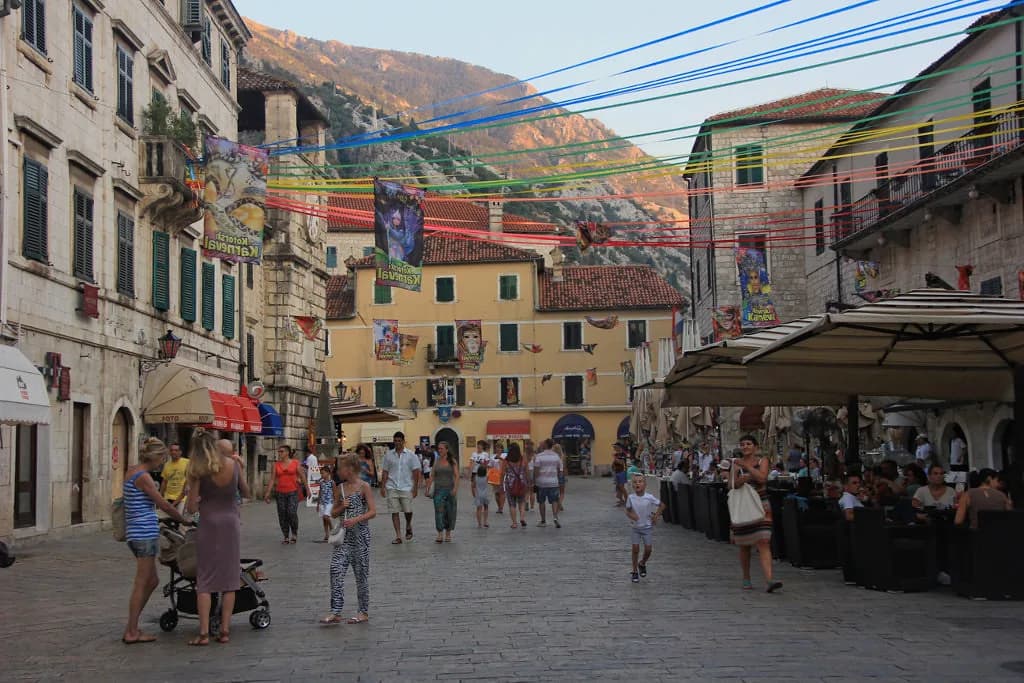
The surviving fabric reads as Venetian because the Republic of Venice held the town for nearly four centuries, until 1797. That is why the palaces and churches in the walled centre look the way they do, and why the town was known as Cattaro while the bay was the Bocche di Cattaro. Walk the squares with that in mind and the architecture stops looking generically Mediterranean.
What Kotor's history comes down to
The short version is a walled town that changed hands repeatedly and was comprehensively rebuilt after a catastrophe in the twentieth century. Because the whole settlement sits inside the UNESCO World Heritage list, the streets themselves carry the history rather than a single ticketed monument. You can move between eras in a few hundred metres, from a Roman predecessor on the same bay to a cathedral damaged and restored more than once.
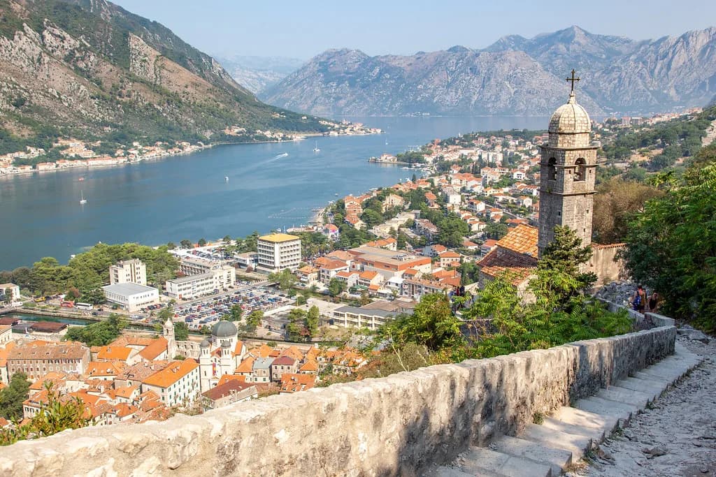
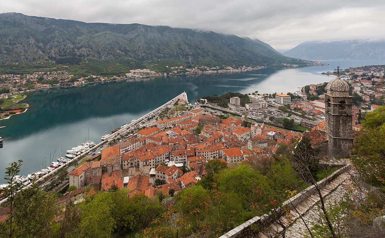
Kotor sits in the corner of the bay beneath the Lovćen and Vrmac massifs, with a coastal road linking it to Perast, Risan and Herceg Novi. The Bay of Kotor is often compared visually to a Norwegian fjord, though its origin is a former river canyon rather than a glacial one. That geography explains why the town grew where it did, pressed between water and a steep mountain face. For orientation before you walk, keep the Kotor Map handy alongside this timeline.
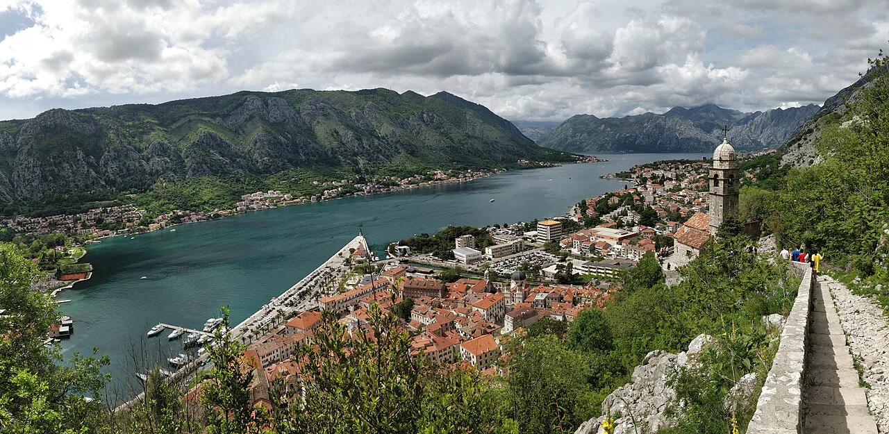
Roman Kotor: Akruvium and the first fortress
Settlements in the area go back to the Neolithic, and the first written mention of the town is dated to 168 BC, when it was called Akruvium and belonged to the Roman province of Dalmatia. The first fortress above the town is recorded as built in 535 under the Emperor Justinian. Neither site is presented to visitors as a Roman ruin you can tour, so treat these as the starting markers of the story rather than a stop on your walk.
After the Roman period the Byzantine Empire took over and the name changed to Decaderon. Byzantine control of the territory ended in 1185. The layers below the medieval town are archaeological rather than visitable, which is why most accounts of Kotor's past begin in earnest with what stands above ground.
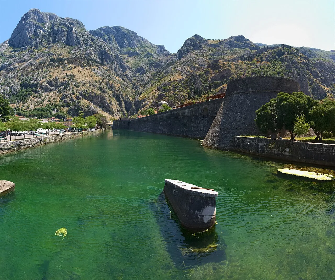
Serbian rule and the prosperous years to 1371
In 1185 the town surrendered to the Serbian Grand Prince Stefan Nemanja, founder of the Nemanjić dynasty, and became a vassal state that kept most of its own governing functions. Serbian rule lasted until 1371, a stretch described as a time of prosperity driven by Catholic faith and active commerce. That combination of trade and church patronage is the period that paid for a good deal of the town's early building.
The prosperity was not uninterrupted. In 1241 Kotor was burned by troops under Kadan, a grandson of Genghis Khan. After 1371 the town spent decades either as an independent republic or under the protection of Bosnia, Hungary or Croatia, which is why the political story becomes harder to summarise than the buildings suggest.
St Tryphon's: a church from 809, a cathedral from 1166
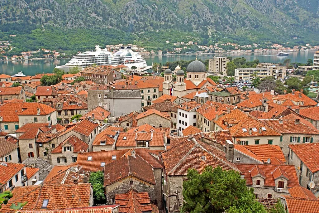
The first church on the site was built in 809 in honour of St Tryphon, before the split between Orthodoxy and Catholicism in 1054. The cathedral that stands there now was initially constructed in 1166 and has been extensively reconstructed after repeated earthquake damage. Look at the slender columns and pink stone supporting the domed roof, and you are looking at a Romanesque building with a long repair history rather than a single moment of construction.
The cathedral sits in the central part of the walled town, on Trg Sv Tripuna, with a museum inside and views over the square. It is the building most associated with the town in visitor accounts, and it anchors the Catholic strand of a place where Orthodox and Catholic worship coexisted for centuries. The Orthodox Church of St Nicholas, on St Luke's Square, brings the other tradition within a short walk.
Venice takes over in 1420: Cattaro and the Bocche
In 1420 the city council accepted the protectorate of the Republic of Venice, and the town became Cattaro while the bay became the Bocche di Cattaro. Venetian influence lasted nearly four centuries, until 1797, and it is the reason you walk past Venetian-style palaces and churches in the Old Town today. If the architecture feels more Italian than Balkan, this is the era to thank for it.
Venice was also defending the bay against the Ottoman Empire, which is the context for the town's fortified shape. The walls you see wrapping the settlement and climbing the mountain were maintained through this period of rivalry, and much of the rampart circuit still stands in good condition. Read the fortifications as a response to that standoff rather than as decoration.
Kotor and Perast hold, Herceg Novi and Risan fall
During the Venetian-Ottoman confrontation, Herceg Novi and Risan passed to the Turks, while Kotor and Perast did not. That distinction is worth holding onto when you compare the towns around the bay, because their later architecture and street patterns reflect different hands. Perast in particular shares Kotor's Venetian alignment rather than the Ottoman one.
The standoff ended with the republic itself. As Venetian power closed in 1797, the town's loyalties and defences changed with the wider collapse of the Republic. The forts and gates are the physical residue of that long contest, and they are best understood as a single defensive system rather than as separate sights.
Napoleon, the Russians and the Congress of Vienna
During the Napoleonic wars the town was occupied by France and came under attack from the British Navy. Citizens turned to Petar I Petrović-Njegoš, the Montenegrin ruler based in Cetinje, who appealed to the Russian Empire; in 1806 Russian ships under Admiral Dmitry Senyavin took Kotor without a fight. The Russians left in 1807 and the French returned until 1813, when the Montenegrin ruler expelled them.
Montenegro briefly gained access to the sea, but the Congress of Vienna in 1814 placed Boka Kotorska within the Kingdom of Dalmatia under Austria-Hungary. Austro-Hungarian rule lasted until 1918 and was marked by frequent unrest, particularly among the Orthodox Serbs. During the First World War, sailors of several nationalities on the Austro-Hungarian ships at the bay raised a red flag and demanded peace, and the revolt is still commemorated locally.
Yugoslavia, 1944 and the socialist decades
In 1918, after the collapse of Austria-Hungary, Kotor and the bay entered the Kingdom of Yugoslavia. During the Second World War the town was under Nazi occupation until 1944, when local partisans liberated it, after which it became part of socialist Yugoslavia. Those decades changed the town's administration more than its street plan, so the medieval core survived largely intact until the earthquake.
The 1979 earthquake, the rebuilding and UNESCO
In 1979 a severe earthquake destroyed houses, cultural monuments and works of art, and the Old Town was badly damaged. It was later rebuilt stone by stone, which is why the centre looks restored rather than ruinous. After the earthquake, the World Heritage Committee listed the Natural and Culturo-historical Region of Kotor, initially also placing it on the List of World Heritage in Danger.
The listing recognised the fortified town and its setting, described by UNESCO as a harmonious integration into the cultivated terraced landscape on the slopes of high rocky hills. Montenegro now has four UNESCO sites and five national parks, with further sites on the tentative list. Knowing the 1979 date helps you read the fabric honestly: much of what you touch is twentieth-century restoration of older material.
Reading the Old Town layout: the Sea Gate and the Main Square
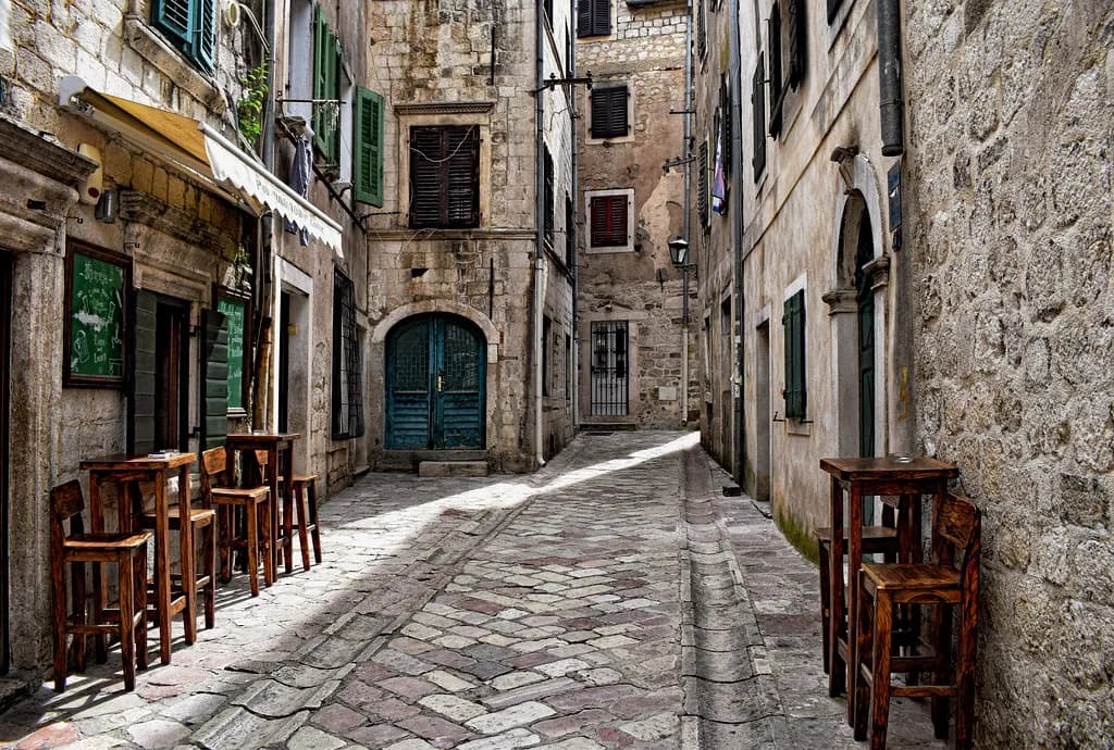
The walled centre is small enough that wandering is the best way to absorb it, and the Kotor Old Town guide covers the layout in more detail. The main entrance is the Sea Gate, built in 1555. Just inside, the Main Square, Trg od Oružja, is the biggest square in the town and holds the Clock Tower.
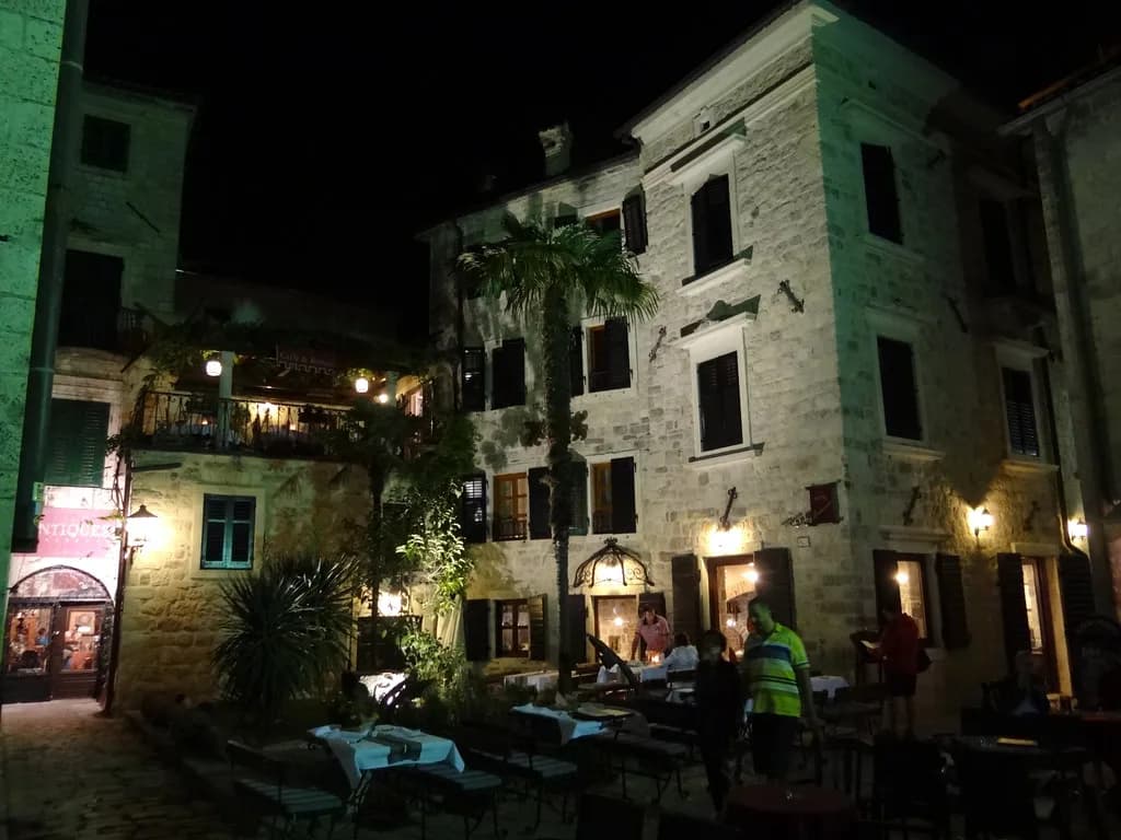
Beyond the square, the streets open onto a series of smaller squares with churches, palaces and private houses mixed in with restaurants. St Tryphon's, St Nicholas, the Maritime Museum and the Cats Museum are all within the compact centre, so you can cover the historical core on foot rather than planning transport between sights.
Walking the history in one afternoon
Start at the Sea Gate, cross Trg od Oružja to the Clock Tower, then take in St Tryphon's Cathedral and the Orthodox Church of St Nicholas. The city walls run for around 4.5 kilometres, parts of them dating back to the ninth century, while the climb to the Castle of San Giovanni is described as one thousand three hundred and fifty steps. Views over the bay open up as you gain height, and you pass the Church of Our Lady of Remedy about halfway.
In 2021 the walls were reported as open around the clock, with a charge to climb between 8am and 8pm from May to October, so climbing earlier, later or outside the season was the way to avoid it. Check the current arrangement and price at the gate before you plan a timed ascent, since both are set by whoever runs the fortress.
Which museum or monument matches which era
For the maritime and trading centuries, the Maritime Museum holds model ships and weapons, while the Cats Museum is a small separate collection whose entry fee goes towards feeding the town's street cats. Both sit within the Old Town, so either can fill a wet hour without leaving the walls.
For the church architecture, St Tryphon's Cathedral carries the earliest strand of the story in its fabric, and St Nicholas brings the Orthodox tradition to the same few streets. The cathedral also has a museum and looks over Trg Sv Tripuna, so it works as a single stop rather than a detour. For the fortifications, the walls themselves are the exhibit.
Which part of Kotor's past do you want to see first?
If you only have time for one thing, take the Old Town streets and St Tryphon's Cathedral, then add the wall climb if the weather is clear. If your interest is maritime trade or church architecture, start with the relevant museum or church and let the walk fill in the rest. Either way, the dates on this page point to buildings you can reach on foot in a single afternoon.
The town's past is unusually legible because so much of it survives in one compact, walkable space, from the Sea Gate of 1555 to a centre rebuilt after 1979. Use the timeline as a filter rather than a checklist, and pick the two or three structures that match what interests you.
Explore more Kotor guides
Sources
Notes for your Montenegro trip
Optional updates to our Montenegro town guides.
You might also like
Continue reading
More guides you'll find useful