Bay of Kotor Guide: Towns, Islands and Getting Around
Plan a Bay of Kotor trip around its four inner bays, the shore towns, Perast's island churches and the Verige strait, with practical bus, car and boat advice.
On this page
The Bay of Kotor is best understood as four linked bays rather than a single town, so the sensible plan is to pick one shore as your base and visit the rest in a loop. The Verige strait separates the bay into the Herceg Novi, Tivat, Risan and Kotor bays, which is why a short ferry crossing or a drive around the coast changes your day completely. This guide covers the towns along the shore, the two island churches off Perast, the boat trips that reach them and the practical choices between bus, car and ferry; the Bay of Kotor Map shows how the pieces fit on the ground.
Use this page to decide the order of your visits and how long each stop deserves, not as a list of everything in Montenegro. Boat departures and ferry timetables vary with the season, so confirm them with the operator before you rely on them.
What the Bay of Kotor is: four inner bays and the Verige strait
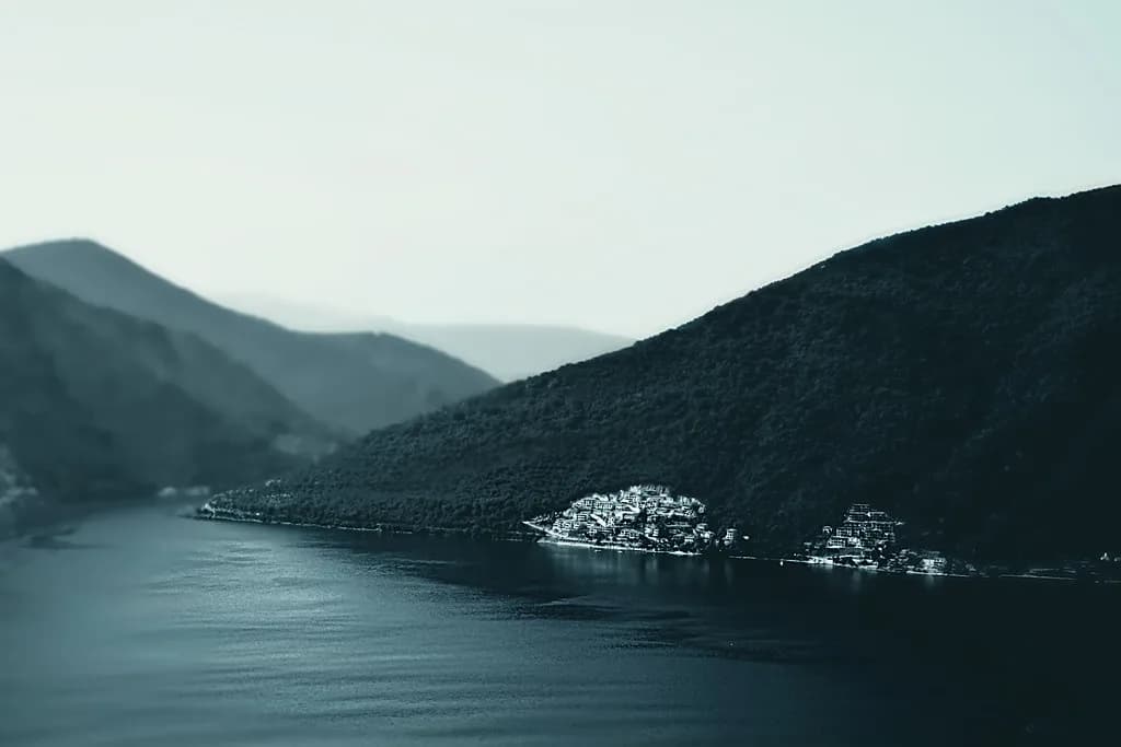
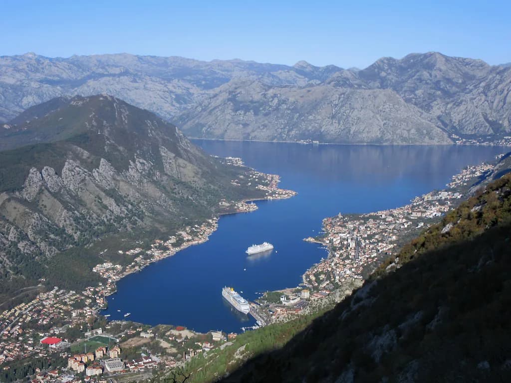
The bay reaches about 28 km inland, covers roughly 87 square kilometres of water and has a coastline of about 106 km, with seven islands. The Verige strait narrows the bay and divides it into four distinct sections, named for Herceg Novi, Tivat, Risan and Kotor; the Bay of Kotor History covers how those shores were settled and fortified. That geography explains why the bay feels like a series of rooms rather than one open stretch of sea.
Mountains frame the water on every side: Lovćen rises to 1,749 m to the south-east, while Orjen, Radostak and Dobrostica close in from the north-west. The result is a sub-Mediterranean climate, with more rain in the inner bay than on the open Montenegrin coast and most of it falling in late autumn and winter. Plan outdoor boat days with that pattern in mind rather than assuming wall-to-wall sun.
You do not need to know the medieval layers to enjoy the bay, but the mix of styles along the shore explains why the towns look so different from one another.
The main towns around the shore and what each one gives you
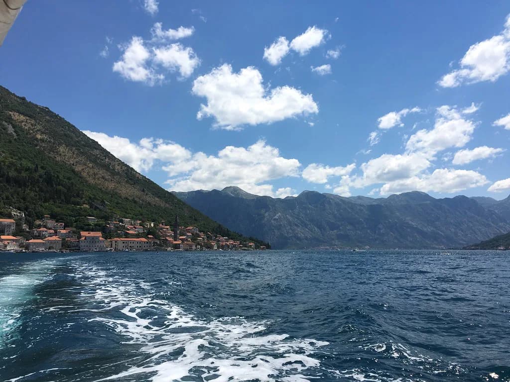
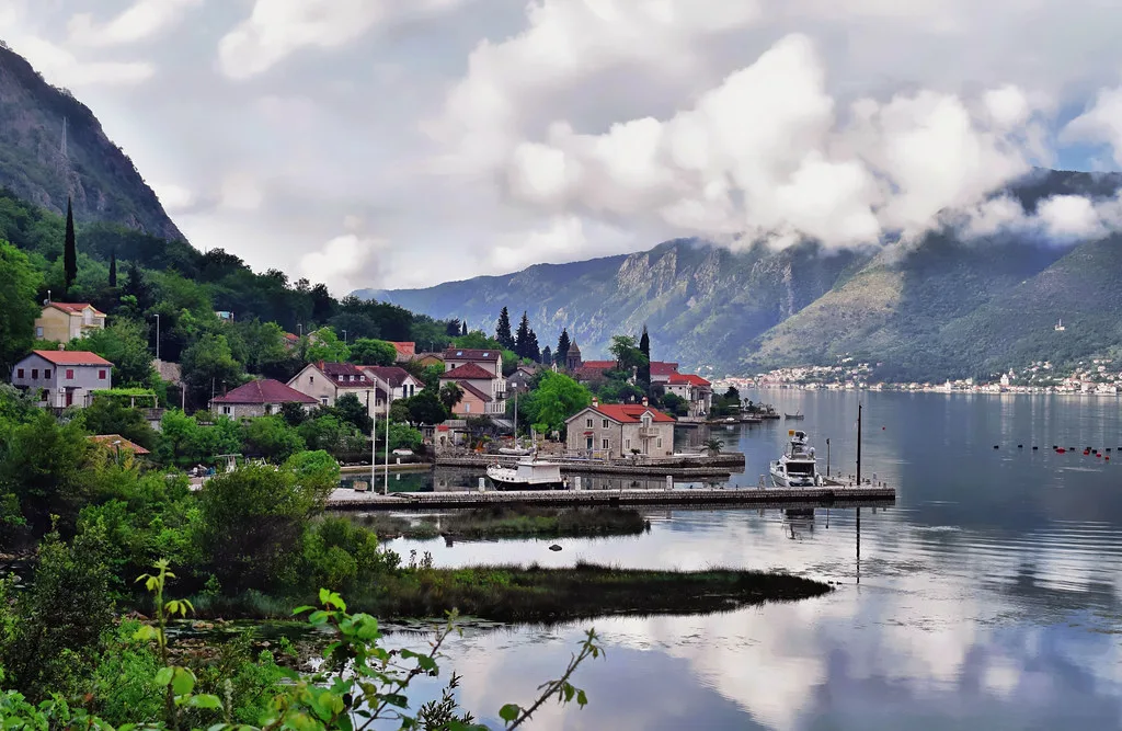
The two towns that carry most of the bay's visitor weight are Kotor, with its walled old town, and Perast, the small baroque town facing the Verige strait. Perast sits almost directly across the water from the strait and is the first thing you see when entering the inner bay, which makes it an easy stop on the way in or out.
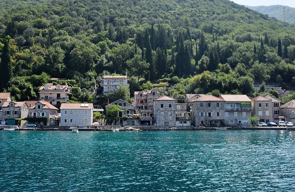
Beyond those two, the shore is a chain of smaller places: Dobrota and Prčanj on the Kotor shore, Risan on the western side of the inner bay, Herceg Novi at the entrance and Tivat on the inner bay. Seeing them in order on a map stops you backtracking along a single coastal road.
Allow at least a day for Kotor and Perast together if you are moving by bus, and longer if you want the island churches as well.
Kotor: the Old Town, the Sea Gate and St Tryphon's Cathedral
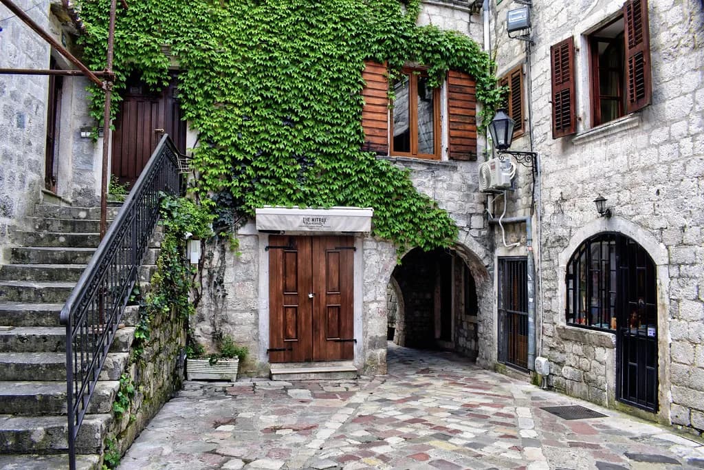
Kotor's old town is the historic core, known for its well-preserved medieval architecture and narrow cobbled streets. The streets are tight and the whole ensemble is best explored on foot, so park or arrive at the edge and walk in. The old town is the natural first stop for anyone arriving by road or by sea.
St Tryphon's Cathedral is the anchor sight within the walls, and the maritime museum covers the bay's seafaring past for anyone who wants context before heading along the shore. Both are in or beside the old town, so you can cover them without a car.
Kotor is also the practical hub for the rest of the bay: boats leave from here, and the coastal road north towards Dobrota and Perast starts at the edge of town.
Dobrota and Prčanj: waterfront villages along the Kotor shore
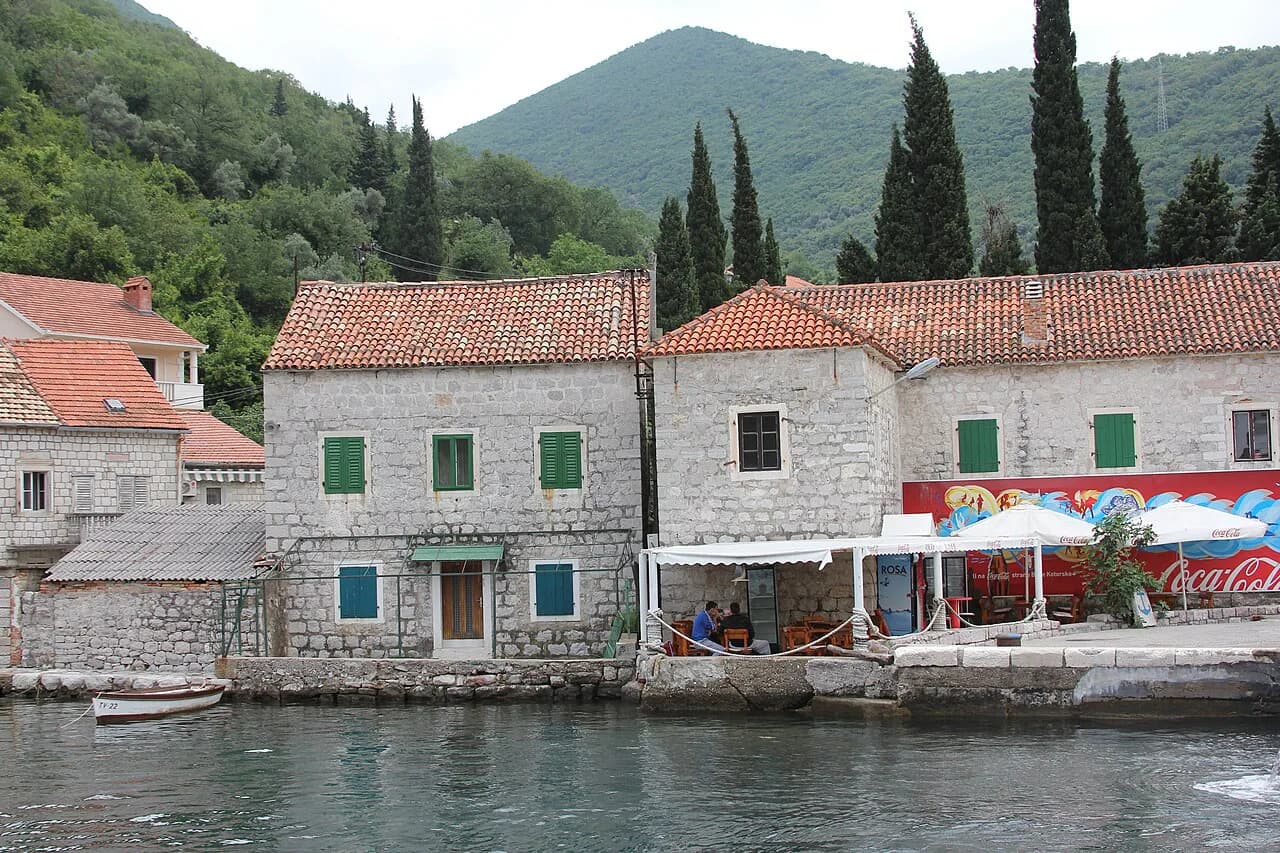
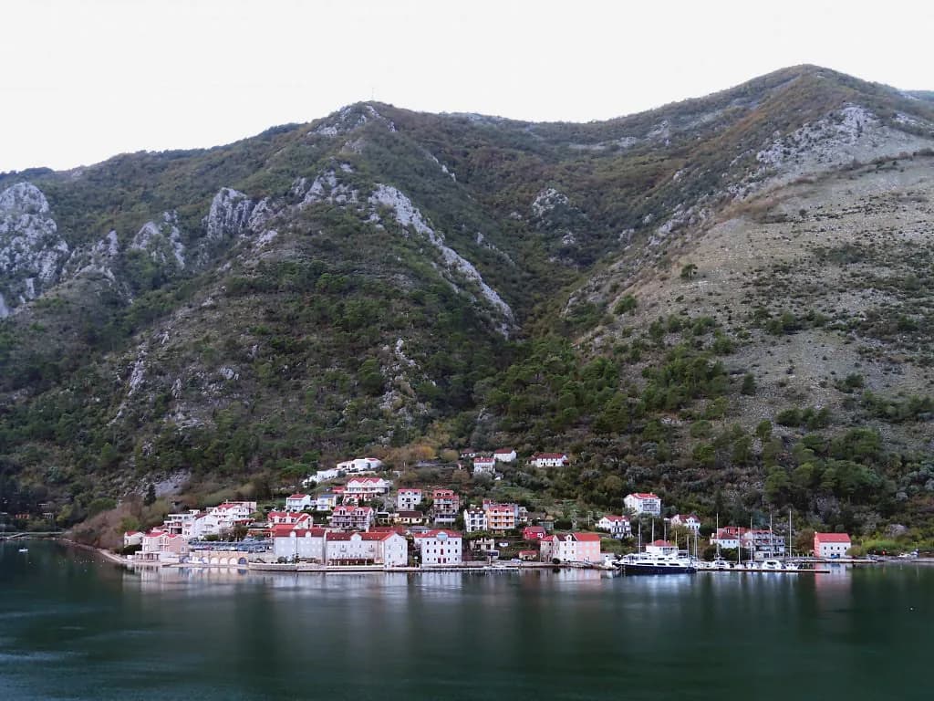
North of Kotor, the shore runs through Dobrota and then Prčanj, both strung along the water with churches and former captains' houses facing the bay. They work well as a slow half-day on foot or by bike if you are based in Kotor and want the waterfront without the crowds inside the walls.
Prčanj sits further along the same shore and is easily combined with Dobrota in one outing, with the coastal road linking the two.
These villages are residential rather than resort-like, so treat them as a walk and a view rather than a full day of sights.
Perast: the promenade, St Nicholas's Church tower and the Perast Museum
Perast is a compact town of baroque buildings facing the water, with a promenade that runs the length of the shore and a main church, St Nicholas's, whose bell tower can be climbed for views over the town and the bay. From the tower you get the clearest sense of how the two island churches sit offshore.
The Perast Museum displays the town's maritime history, which makes it a sensible indoor stop if the weather turns. Perast's wealth came from its position at the entrance to the inner bay, and the surviving palaces and churches along the waterfront still show it.
Give Perast a couple of hours on foot, plus whatever time you add for the museum or the tower.
Gospa od Škrpjela (Our Lady of the Rocks) and Sveti Đorđe: the two island churches
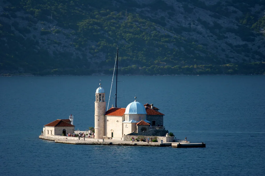
Two small islands lie just offshore from Perast: Sveti Đorđe, the smaller, and Gospa od Škrpjela, known in English as Our Lady of the Rocks, the larger. Boats run from Perast to the islands, and the crossing was quoted at five euros per person.
Both islands are churches rather than beaches, so dress and behaviour should match a place of worship: cover shoulders and knees where you can, keep voices low and do not treat the interiors as photo backdrops. Small boats cross in calm weather, and windy or wet days can suspend the crossing, so keep the islands flexible in your plan.
Confirm the current crossing price and boat times with the operators in Perast on the day, as these are seasonal.
Risan and the bay's western shore
Risan sits on the western side of the inner bay, one of the four sections the Verige strait divides the water into. It is quieter than Kotor or Perast and works as a stop on a drive around the bay rather than a destination in its own right.
If you are driving the full circuit, Risan is the natural pause between Perast and the climb towards the western entrance to the bay.
Herceg Novi and the Kanli Kula fortress
Herceg Novi guards the entrance to the bay, and the Kanli Kula fortress sits above the town with views out towards the open sea. It gives you a different perspective from Kotor: here you look out of the bay rather than deep into it.
The town's stepped streets drop down to the waterfront, so expect a walk with some climbing between the fortress and the shore.
Tivat and the inner bay
Tivat sits on the inner bay close to the Verige strait, which makes it a useful point on a loop between the Kotor and Herceg Novi shores. Because the strait is narrow here, the two sides of the water feel close even when the road route is longer.
Tivat works best as a transit stop rather than a sightseeing day of its own.
Getting around by bus
Buses link the towns along the shore, and Kotor is the most useful interchange for reaching Perast, Dobrota and the coastal villages. Check the last return service before you set out rather than assuming a late bus.
For a day combining Kotor and Perast, the bus is the simplest option because parking in Perast is limited and the waterfront is short.
Getting around by car and the Kamenari ferry across the Verige strait
A car gives you the freedom to string together Risan, Perast, Dobrota and Herceg Novi in one loop, but the coastal road is slow in summer traffic. The alternative is the short ferry across the Verige strait, which cuts the drive between the two shores.
The crossing links Kamenari on the Herceg Novi side with Lepetane near Tivat, and it is a route decision rather than a scenic detour: it saves you the long drive around the bay. Check sailing times on the day.
If you are driving, the bay is within easy reach by road, and the coastal approach gives you the first view of the inner bay as you come round the bends.
Boat trips and speedboat tours: what they cover and what they cost in euros
Boat trips from Kotor cover the highlights of the bay by water, typically combining Perast, the island churches and, on longer outings, the Blue Cave. A speedboat is the fastest way to see the mountain scenery, the towns and the coves that the road cannot reach.
Private boat hire is priced per boat rather than per person: a boat for up to eight passengers was listed from 90 euros, one for up to ten from 150 euros, and a boat for up to twenty from 300 euros. Shared and private tours are priced separately, so compare per-person and per-boat rates before booking.
Book through an operator with a clear meeting point in Kotor and confirm what the trip includes, since island landings and cave stops vary between tours.
Cruise-day crowds in Kotor and how to time a visit
Kotor's old town is small, and when a cruise ship is in port the streets fill quickly. The practical fix is to visit the old town early or late and spend the middle of the day on the water or in Perast, then return when the crowds thin.
Dobrota and Prčanj make good bolt-holes on busy days, since they are a short ride from Kotor but away from the walled centre.
How long you need for the bay
One full day covers Kotor's old town and Perast with the island crossing, but two days let you add the western shore and Herceg Novi without rushing. Three days gives you room for a boat trip and a slow morning in one of the waterfront villages.
A sensible short itinerary runs Kotor first thing, Perast and the islands before lunch, then the ferry or the coastal road to the other shore for the afternoon.
If you are extending beyond the bay, Budva and the coast south of it are a separate trip rather than a morning add-on.
Should you base yourself in Kotor or Perast?
Base in Kotor if you want the old town, the bus links and boat departures on your doorstep; base in Perast if you want the islands and the promenade without the cruise crowds. Either way, keep one day flexible for the water, because wind and rain can cancel small-boat crossings.
Decide your loop before you arrive, check ferry and boat times the day before, and carry euros for island crossings and small operators.
Explore more Bay of Kotor guides
- Bay of Kotor History
- Bay of Kotor Map
- Dobrota: A Guide to the Waterfront Village North of Kotor
- Lepetane
- Muo, Montenegro
- Prčanj: What to See in the Bay of Kotor's Waterfront Village
- Risan, Montenegro
- The Kamenari
- Kostanjica, Montenegro
- Morinj: A Bay of Kotor Village of Springs and Stone Mills
- Stoliv: Guide to the Upper and Lower Village on the Bay of Kotor
Frequently Asked Questions
How do you get to Our Lady of the Rocks from Perast?
Small boats run from the Perast waterfront to the two islands offshore, Sveti Đorđe and Gospa od Škrpjela, known in English as Our Lady of the Rocks. The crossing was quoted at five euros per person. Treat both as churches: cover shoulders and knees where you can and keep quiet inside. Crossings depend on calm weather, so keep the islands flexible in your plan and confirm the price and timing with the operators in Perast.
Do you need a car to see the Bay of Kotor?
No. Buses link Kotor with Perast and the waterfront villages, and boat trips reach the islands and the Blue Cave without a car. A car helps if you want to combine Risan, Perast, Dobrota and Herceg Novi in one day, though the coastal road is slow in summer. The Kamenari–Lepetane ferry across the Verige strait cuts the drive between the two shores.
Which towns around the bay should you prioritise?
Kotor and Perast carry most of the visitor interest, with Kotor's old town, St Tryphon's Cathedral and its medieval architecture in one compact walled area. Add the island churches off Perast, then choose one of the western shore, Herceg Novi and the Kanli Kula fortress, or Tivat on the inner bay depending on how much time you have.
Sources
Notes for your Montenegro trip
Optional updates to our Montenegro town guides.
You might also like
Continue reading
More guides you'll find useful